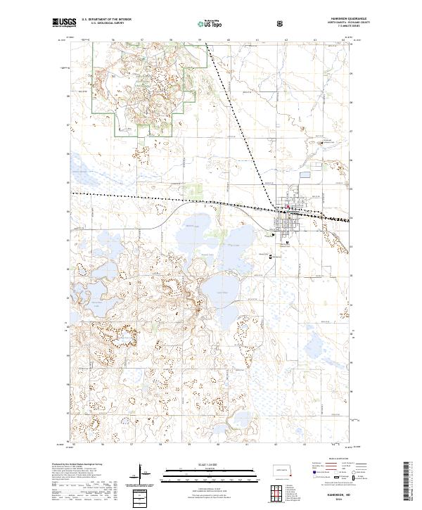
2024 Map of Hankinson
USGS Topo · Published 2024About this map
Hankinson serves as the primary hub in this corner of Richland County, where the Cpkc railroad line cuts through a landscape defined by glacial prairie potholes and conservation lands. The town is notable for its concentration of local history markers, including United Cem, Calvary Cem, and the Saint Francis Convent Cem. Surrounding the settlement, the terrain shifts from the protected reaches of the Sheyenne National Grassland in the northwest to the expansive Richland County Waterfowl Production Area. Numerous water bodies such as Lake Elsie, Round Lake, and Stacks Slough illustrate the region's importance for migratory birds and local recreation. The Hankinson Hills provide a subtle rise in elevation above the wetlands, while the sectioned grid of county roads, such as Co Rd 15, facilitates access to the scattered rural cemeteries and lakefront properties.
Find a feature on this map
63 named features on this map. Tap any name to fly to it.
Don’t see what you’re looking for? This feature index may not catch every label — zoom into the map to look around manually.
Map Details
Editions of this 2024 Hankinson Map
This is the sole edition of this map. No revisions or reprints were ever made.
Other maps of this area

1904 · Wahpeton
USGS Topo · 1:125,000

1907 · Wyndmere
USGS Topo · 1:125,000

1917 · New Effington
USGS Topo · 1:62,500

1953 · Milbank
USGS Topo · 1:250,000

1953 · Fargo
USGS Topo · 1:250,000

1956 · Fargo
USGS Topo · 1:250,000

1958 · Milbank
USGS Topo · 1:250,000

1964 · Hankinson
USGS Topo · 1:24,000

1964 · Mantador
USGS Topo · 1:24,000

1964 · Moselle
USGS Topo · 1:24,000