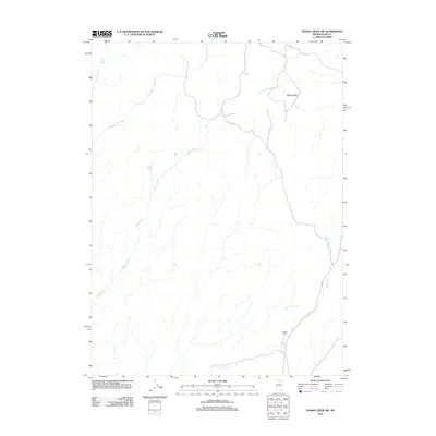
2012 Map of Hanks Creek SW
USGS Topo · Published 2012About this map
Itcaina Corral sits as a primary landmark in this drainage basin of northeastern Nevada, illustrating the livestock and ranching heritage that has long defined this part of Elko County. The landscape is heavily influenced by a network of seasonal and perennial water sources, including Horse Creek, Cottonwood Creek, and the long reach of Indian Creek. These waterways originate from higher ground, punctuated by essential water points like Horse Creek Spring and the two Union Spring locations. In the northeast corner, the Mallard Hills overlook the South Fork Hanks Creek, while Co HWY 747 and a series of light-duty roads trace the contours of the valley floor near Pole Creek. This map reveals the critical infrastructure of high-desert ranching, where the distribution of water determines the utility of the land.
Find a feature on this map
11 named features on this map. Tap any name to fly to it.
Don’t see what you’re looking for? This feature index may not catch every label — zoom into the map to look around manually.
Map Details
Editions of this 2012 Hanks Creek SW Map
This is the sole edition of this map. No revisions or reprints were ever made.
Other maps of this area

1955 · Wells
USGS Topo · 1:250,000

1958 · Wells
USGS Topo · 1:250,000

1961 · Wells
USGS Topo · 1:250,000

1967 · Hanks Creek SW
USGS Topo · 1:24,000

1967 · Hot Springs Creek
USGS Topo · 1:24,000

1967 · Twin Buttes
USGS Topo · 1:24,000

1967 · Stag Mountain
USGS Topo · 1:24,000

1967 · Peko Peak
USGS Topo · 1:24,000

1967 · Hanks Creek NE
USGS Topo · 1:24,000

1971 · Devils Armchair
USGS Topo · 1:24,000