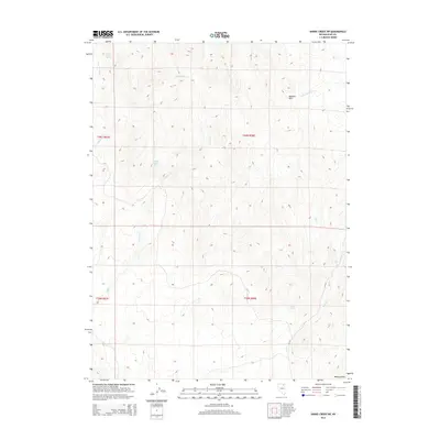
2014 Map of Hanks Creek SW
USGS Topo · Published 2014About this map
Horse Creek Spring provides a vital point of interest in this high-desert landscape of northeastern Nevada. The drainage patterns of the region are defined by Horse Creek in the northwest and the winding course of Cottonwood Cr as it moves across the western sections of the township. In the northeastern quadrant, the S. Fork Hanks Cr begins its descent through the terrain. This 2014 survey by the U.S. Geological Survey documents the elevation contours and natural water sources that have historically dictated land use and ranching potential in Elko County, showing the proximity of these seasonal and perennial flows to the established section lines of the Public Land Survey System.
Find a feature on this map
4 named features on this map. Tap any name to fly to it.
Don’t see what you’re looking for? This feature index may not catch every label — zoom into the map to look around manually.
Map Details
Editions of this 2014 Hanks Creek SW Map
This is the sole edition of this map. No revisions or reprints were ever made.
Other maps of this area

1955 · Wells
USGS Topo · 1:250,000

1958 · Wells
USGS Topo · 1:250,000

1961 · Wells
USGS Topo · 1:250,000

1967 · Hanks Creek SW
USGS Topo · 1:24,000

1967 · Hot Springs Creek
USGS Topo · 1:24,000

1967 · Twin Buttes
USGS Topo · 1:24,000

1967 · Stag Mountain
USGS Topo · 1:24,000

1967 · Peko Peak
USGS Topo · 1:24,000

1967 · Hanks Creek NE
USGS Topo · 1:24,000

1971 · Devils Armchair
USGS Topo · 1:24,000