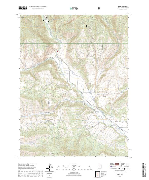
2023 Map of Hanna
USGS Topo · Published 2023About this map
The settlement of Hanna serves as the focal point in this high-altitude corner of the Uinta Valley, where the West Fork Duchesne River joins the main stem of the Duchesne River. This landscape is defined by the complex water-management systems essential to the region, featuring the Rhoades Canal and Farm Creek Canal which trace the contours of Dutchmans Flat. The terrain rises sharply toward the Ashley National Forest, punctuated by prominent landmarks such as The Mesa, The Hens Nest, and Tabby Mtn. Historically significant transport routes including the N Fork Rd and Tabby Swale Rd navigate the canyons and ridges, while local landmarks like Lookout Point and Red Cliff provide geographic orientation in this sparsely settled valley floor.
Find a feature on this map
33 named features on this map. Tap any name to fly to it.
Don’t see what you’re looking for? This feature index may not catch every label — zoom into the map to look around manually.
Map Details
Editions of this 2023 Hanna Map
This is the sole edition of this map. No revisions or reprints were ever made.
Other maps of this area

1885 · Uinta
USGS Topo · 1:250,000

1901 · Hayden Peak
USGS Topo · 1:125,000

1903 · Hayden Peak
USGS Topo · 1:125,000

1954 · Salt Lake City
USGS Topo · 1:250,000

1958 · Salt Lake City
USGS Topo · 1:250,000

1960 · Salt Lake City
USGS Topo · 1:250,000
1962 · Wolf Creek
USGS Topo · 1:24,000

1962 · Hanna
USGS Topo · 1:24,000

1962 · Tabiona
USGS Topo · 1:24,000

1962 · Raspberry Knoll
USGS Topo · 1:24,000