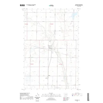
2020 Map of Hannaford
USGS Topo · Published 2020About this map
Hannaford and the smaller community of Walum anchor this agricultural landscape in Griggs County, where the meandering course of Baldhill Creek cuts through the plains. The map reveals a high concentration of sites for local history and genealogy, notably the scattered rural burial grounds including Faith Lutheran Cem, Lyster Cem, and Saint Olafs Lutheran Cem. These sites, along with the Hannaford Cem just west of town, suggest the enduring presence of early 20th-century Scandinavian and Lutheran heritage in the region. The drainage patterns of Silver Creek and Gunderson Cr define the low-lying areas between the township lines of t145n r60w and t144n r59w. The rectilinear grid of county roads, such as Griggs Co 22 and Co Rd 28, contrasts with the organic flow of the local creek systems.
Find a feature on this map
31 named features on this map. Tap any name to fly to it.
Don’t see what you’re looking for? This feature index may not catch every label — zoom into the map to look around manually.
Map Details
Editions of this 2020 Hannaford Map
This is the sole edition of this map. No revisions or reprints were ever made.
Other maps of this area

1952 · New Rockford
USGS Topo · 1:250,000

1956 · New Rockford
USGS Topo · 1:250,000

1961 · Cooperstown East
USGS Topo · 1:24,000

1961 · Revere
USGS Topo · 1:24,000

1961 · Hannaford
USGS Topo · 1:24,000

1961 · Wimbledon NE
USGS Topo · 1:24,000

1961 · Cooperstown West
USGS Topo · 1:24,000

1961 · Sutton NE
USGS Topo · 1:24,000

1961 · Dazey NE
USGS Topo · 1:24,000

1961 · Dazey
USGS Topo · 1:24,000