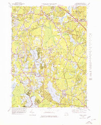
1978 Map of Hanover
USGS Topo · Published 1979About this map
Silver Lake and the interconnected waters of Monponsett Pond dominate this landscape, illustrating the critical role of freshwater resources in the development of Plymouth County. The map details a sophisticated network of Cranberry Bogs that thread through the lowlands between Hanover and Pembroke, representing a defining agricultural industry of the region during the late twentieth century. Settlement patterns are concentrated around historic nodes like Hanover Center and South Hanover, while the rural character of Halifax and Hanson is preserved in large tracts like the Hanson Town Forest.
Find a feature on this map
119 named features on this map. Tap any name to fly to it.
Don’t see what you’re looking for? This feature index may not catch every label — zoom into the map to look around manually.
Map Details
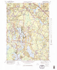
Editions of this 1978 Hanover Map
2 editions found
Other maps of this area

1885 · Abington
USGS Topo · 1:62,500

1885 · Duxbury
USGS Topo · 1:62,500

1885 · Middleboro
USGS Topo · 1:62,500

1886 · Plymouth
USGS Topo · 1:62,500

1888 · Duxbury
USGS Topo · 1:62,500

1888 · Middleboro
USGS Topo · 1:62,500

1888 · Abington
USGS Topo · 1:62,500

1889 · Plymouth
USGS Topo · 1:62,500

1893 · Abington
USGS Topo · 1:62,500

1893 · Duxbury
USGS Topo · 1:62,500