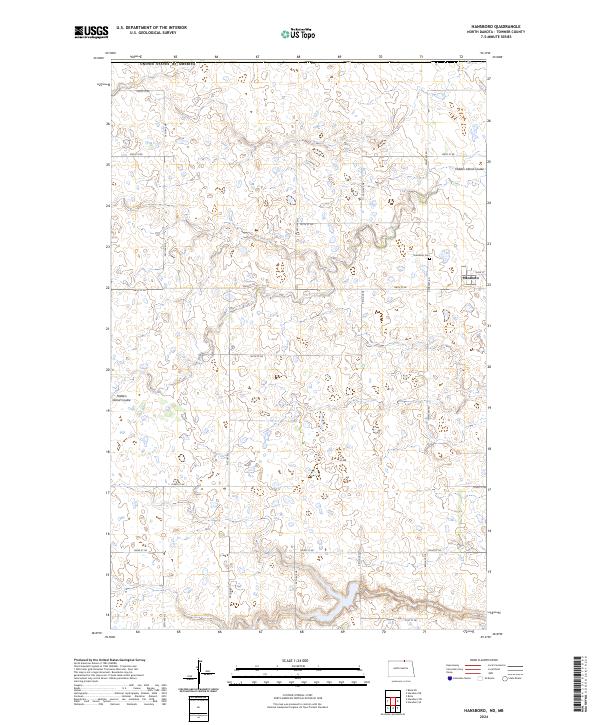
2024 Map of Hansboro
USGS Topo · Published 2024About this map
Hansboro sits at the northern edge of Towner County, positioned just below the international boundary of the United States of America. This agricultural landscape is defined by the prairie pothole region's characteristic wetlands and small water bodies, with the winding path of Hidden Island Coulee cutting through the terrain. The town's layout is centered on Main St, with the local history of the community anchored at the Hansboro Cem located to the north along Cemetery Rd. The map reveals a highly structured section-line road network, including thoroughfares like Picton Rd and 56th Ave NE, which facilitated the transport of grain and livestock across these northern plains. This survey reflects the enduring rural character of North Dakota's border country, where the land is strictly partitioned into townships such as t164n r68w and t163n r67w.
Find a feature on this map
25 named features on this map. Tap any name to fly to it.
Don’t see what you’re looking for? This feature index may not catch every label — zoom into the map to look around manually.
Map Details
Editions of this 2024 Hansboro Map
This is the sole edition of this map. No revisions or reprints were ever made.
Other maps of this area

1953 · Devils Lake
USGS Topo · 1:250,000

1956 · Devils Lake
USGS Topo · 1:250,000
1969 · Hansboro NE
USGS Topo · 1:24,000
1969 · Hansboro
USGS Topo · 1:24,000

1969 · Rolla NE
USGS Topo · 1:24,000

1970 · Hansboro SW
USGS Topo · 1:24,000

1970 · Hansboro SE
USGS Topo · 1:24,000

1970 · Rolla
USGS Topo · 1:24,000

1985 · Rock Lake
USGS Topo · 1:100,000
2011 · Hansboro SW
USGS Topo · 1:24,000