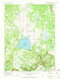
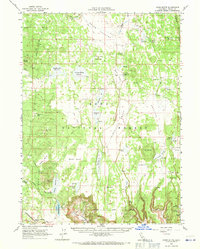
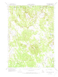
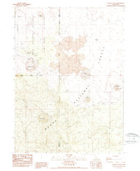
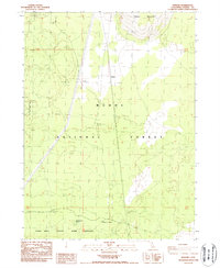
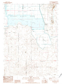
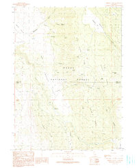
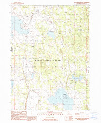
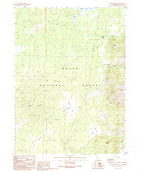
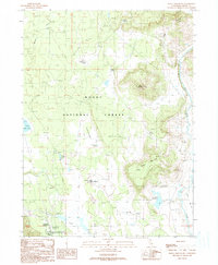
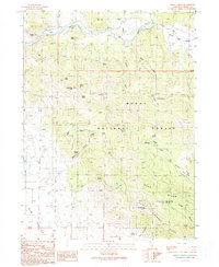
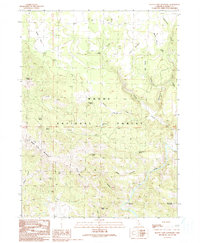
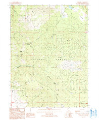
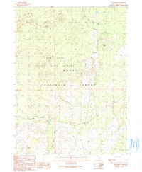
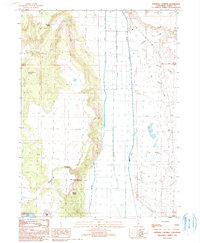
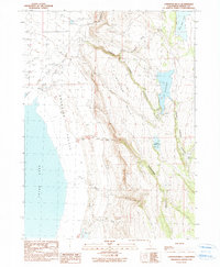
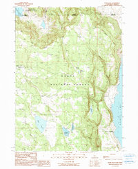
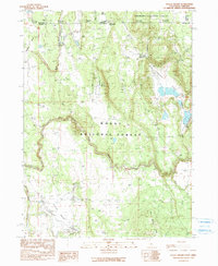
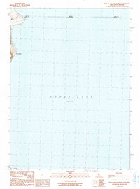
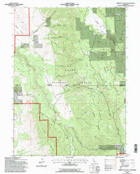
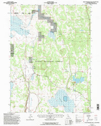
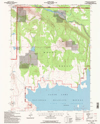
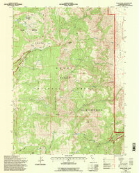
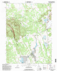
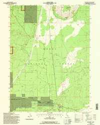
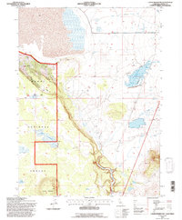
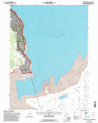
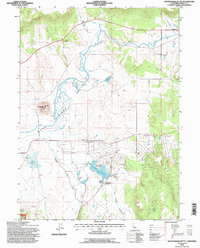
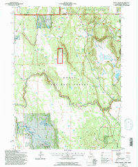
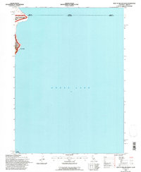
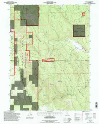
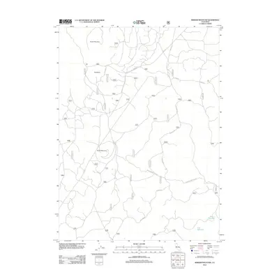
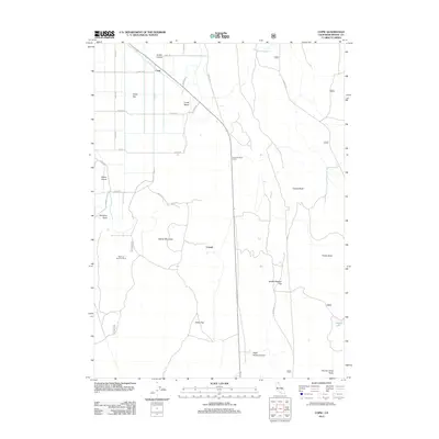
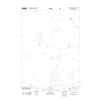
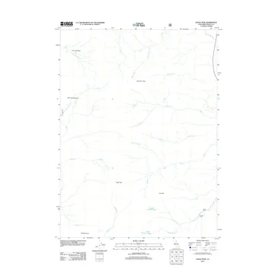
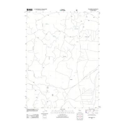
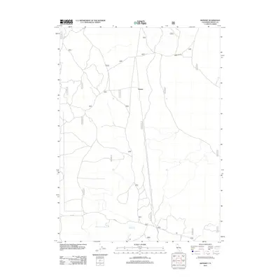
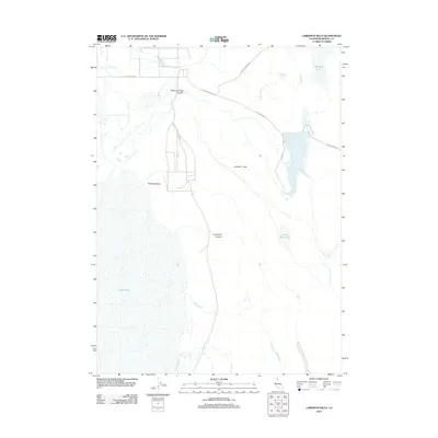
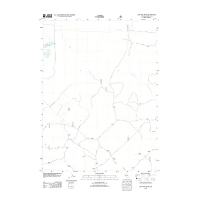
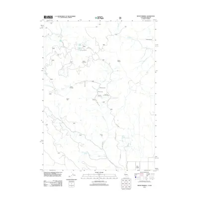
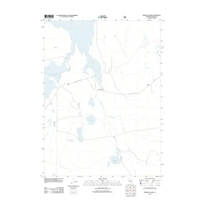
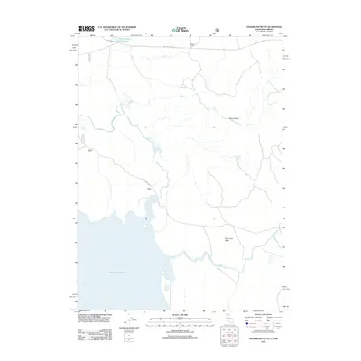
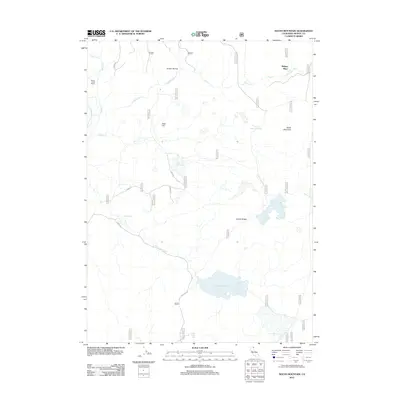
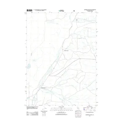
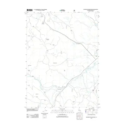
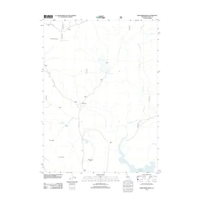
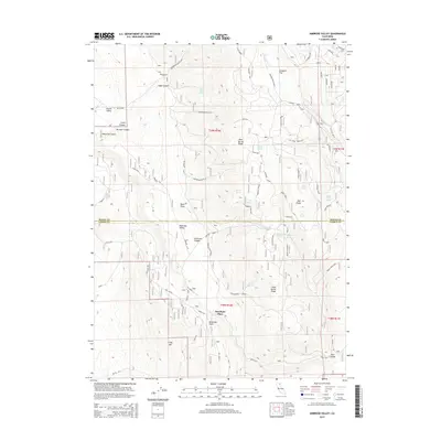
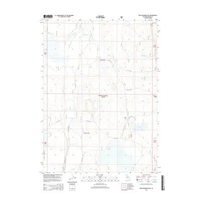
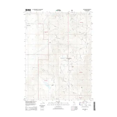
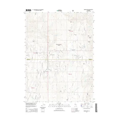
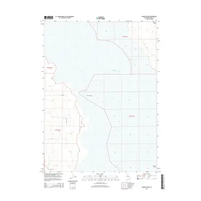
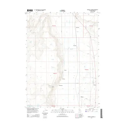
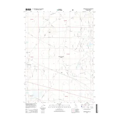
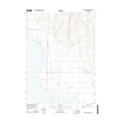
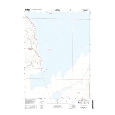
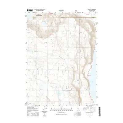
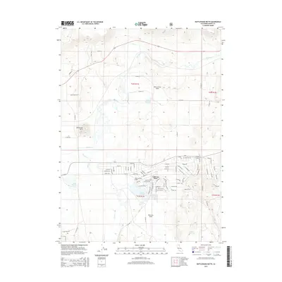
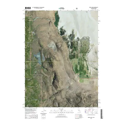
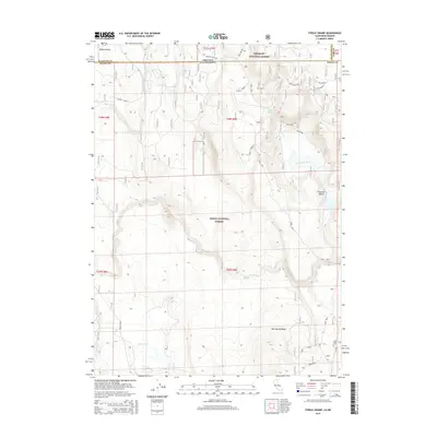
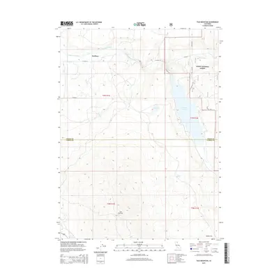
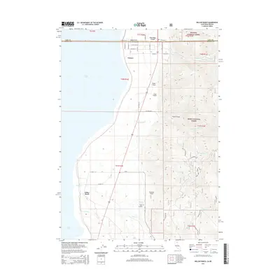
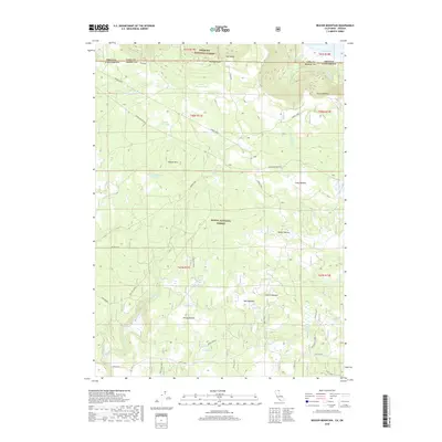
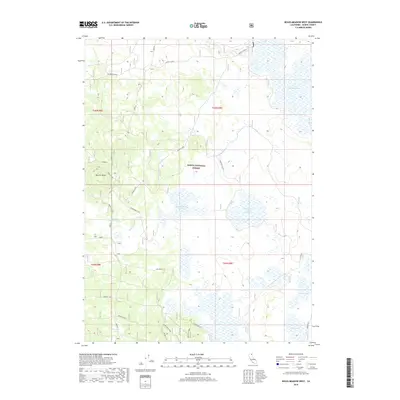
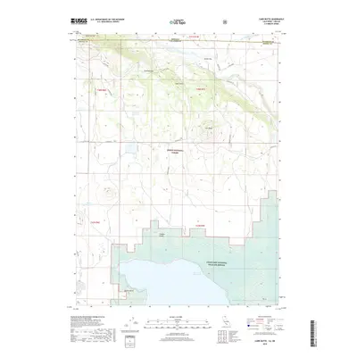
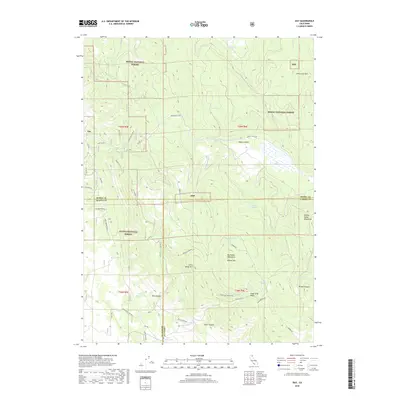
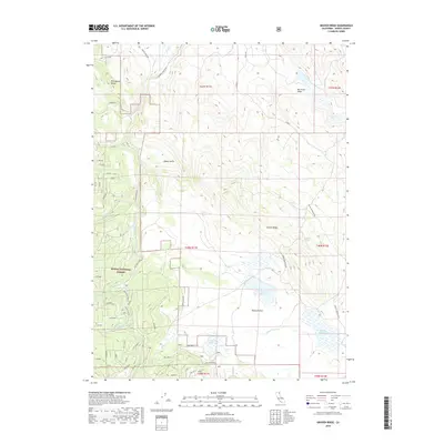
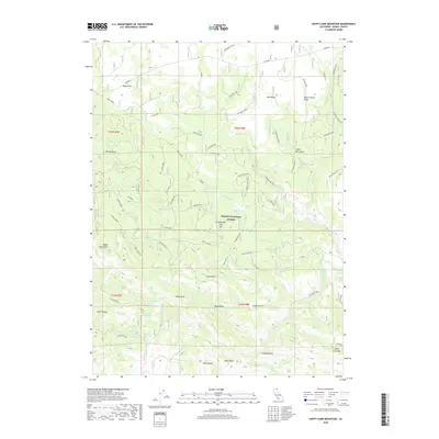
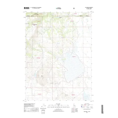
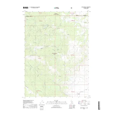
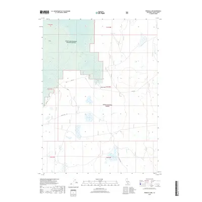
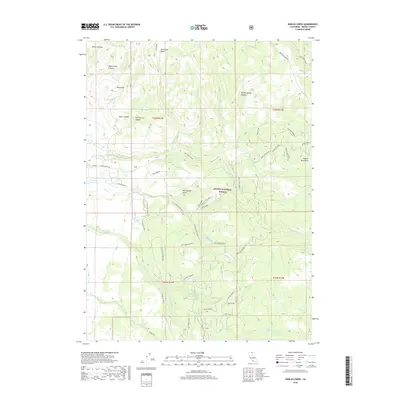
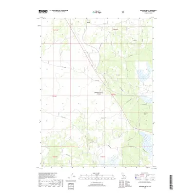
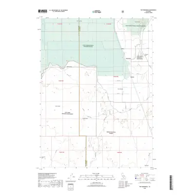
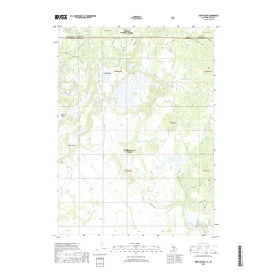
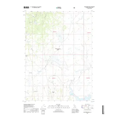
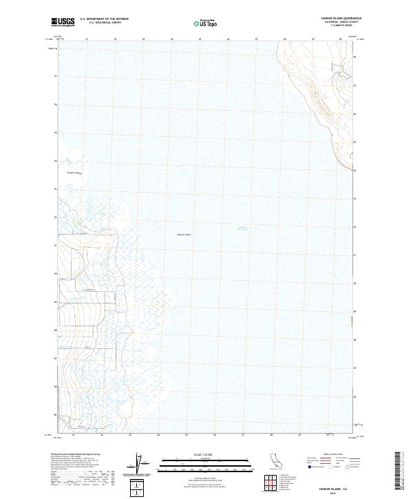
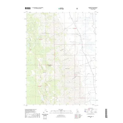
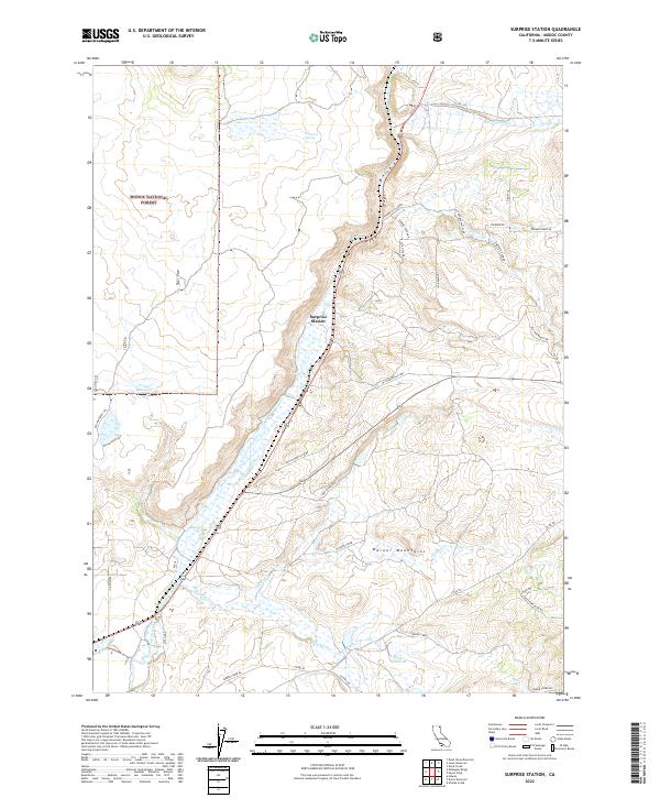
1963 Map of Hansen Island
USGS Topo · Published 1964About this map
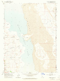
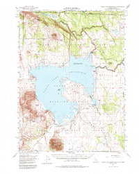
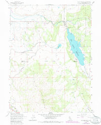
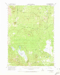
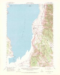
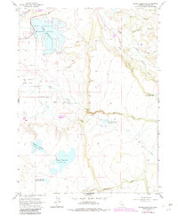
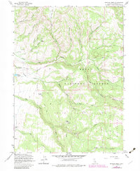
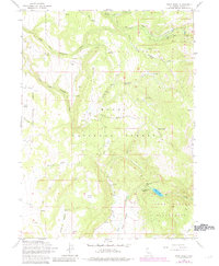
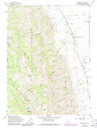
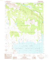
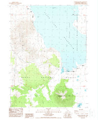
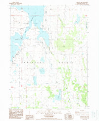
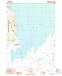
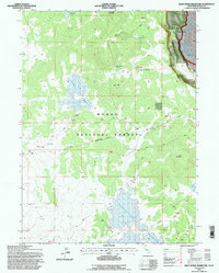
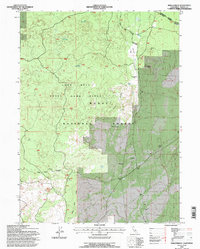
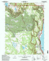
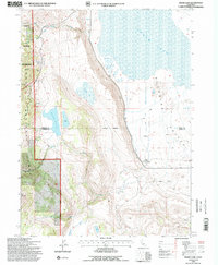
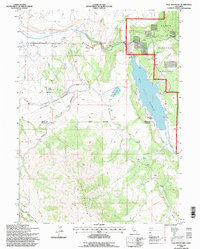
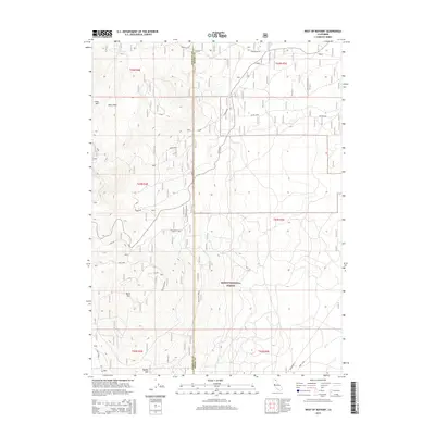
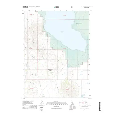
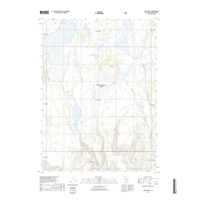
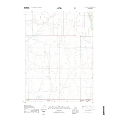
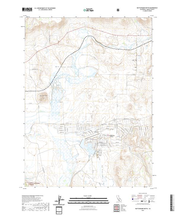
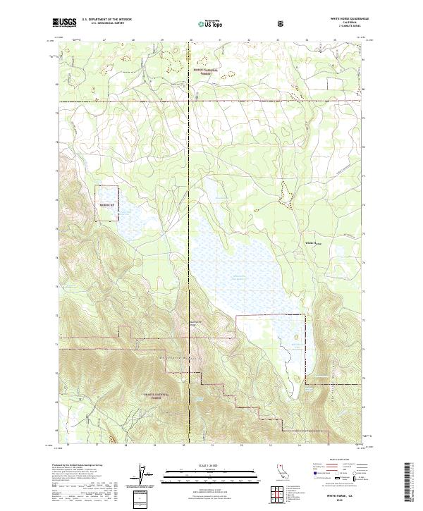
Middle Alkali Lake dominates the center of this 1963 survey, reflecting the arid hydrology of eastern Modoc County. The shoreline is characterized by numerous water sources, including a series of Flowing Wells and Springs that supported the early ranching efforts in the western Surprise Valley. The presence of Cottonwood Creek and Owl Creek suggest seasonal drainages that provided vital water to the lowlands along Surprise Valley Road. On the eastern shore, the terrain rises toward the California-Nevada state line, where the landscape is crossed by a Jeep Trail and intermittent drainages like Bull Creek. The map documents a sparsely settled region where survival was closely tied to the few named water features like Fortynine Creek and the central prominence of Hansen Island.
Find a feature on this map
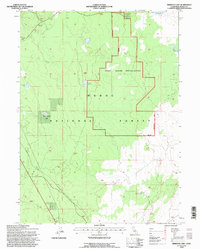
15 named features on this map. Tap any name to fly to it.
Don’t see what you’re looking for? This feature index may not catch every label — zoom into the map to look around manually.
Map Details
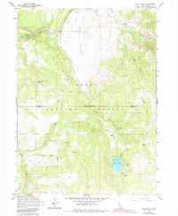
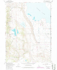
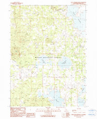
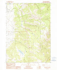
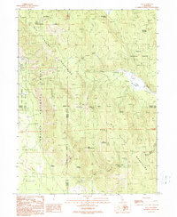
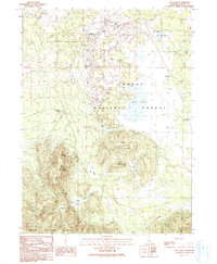
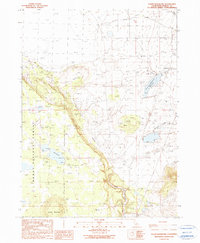
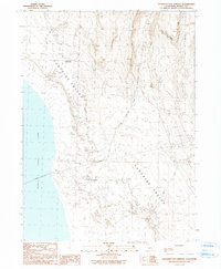
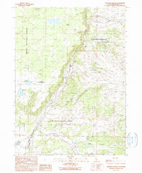
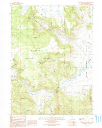
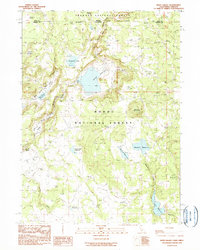
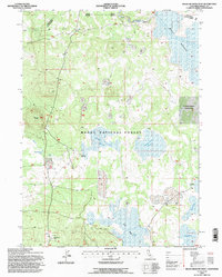
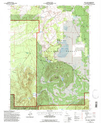
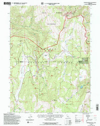
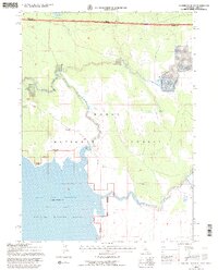
Editions of this 1963 Hansen Island Map
2 editions found
Historical Maps of Modoc County Through Time
441 maps found
1951 Clear Lake Reservoir
Modoc County, CA
1952 Hackamore
Modoc County, CA
1952 Timber Mountain
Modoc County, CA
1962 Big Sage Reservoir
Modoc County, CA
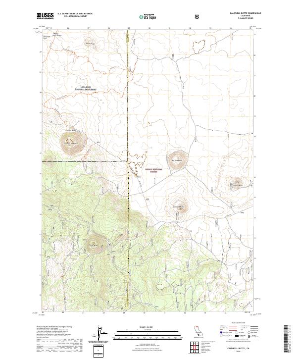
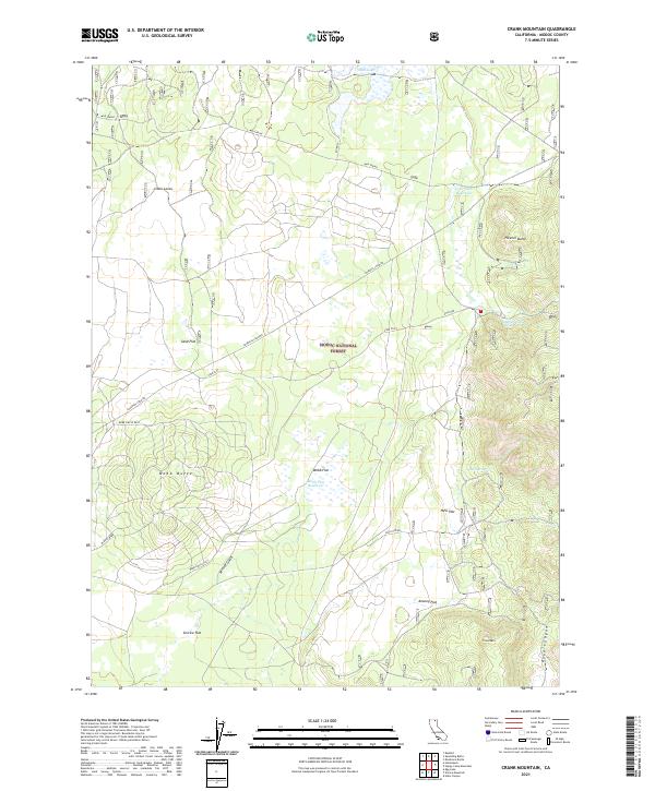
1962 Crank Mountain
Modoc County, CA
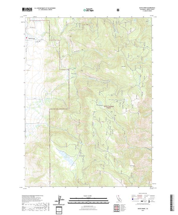
1962 Davis Creek
Modoc County, CA
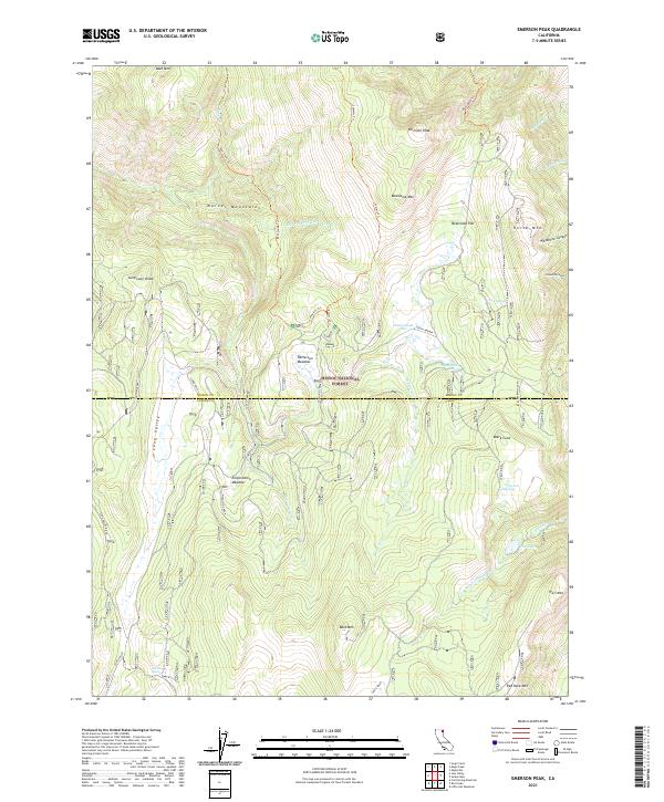
1962 Emerson Peak
Modoc County, CA
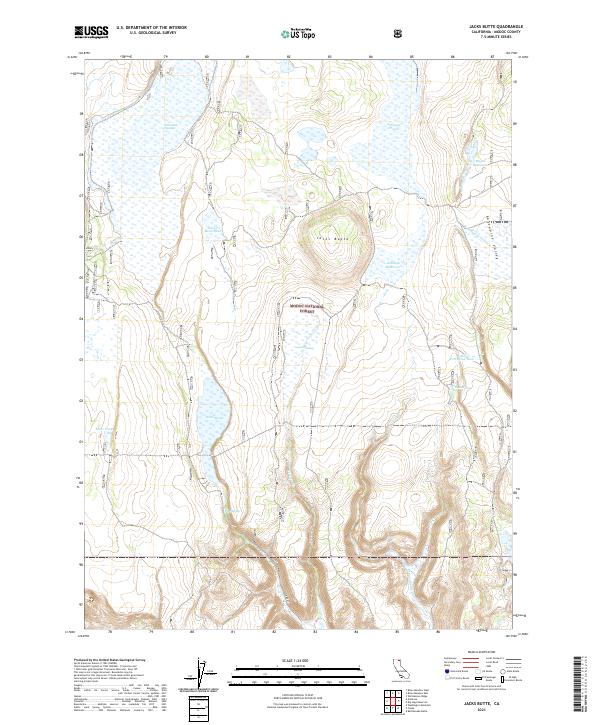
1962 Jacks Butte
Modoc County, CA
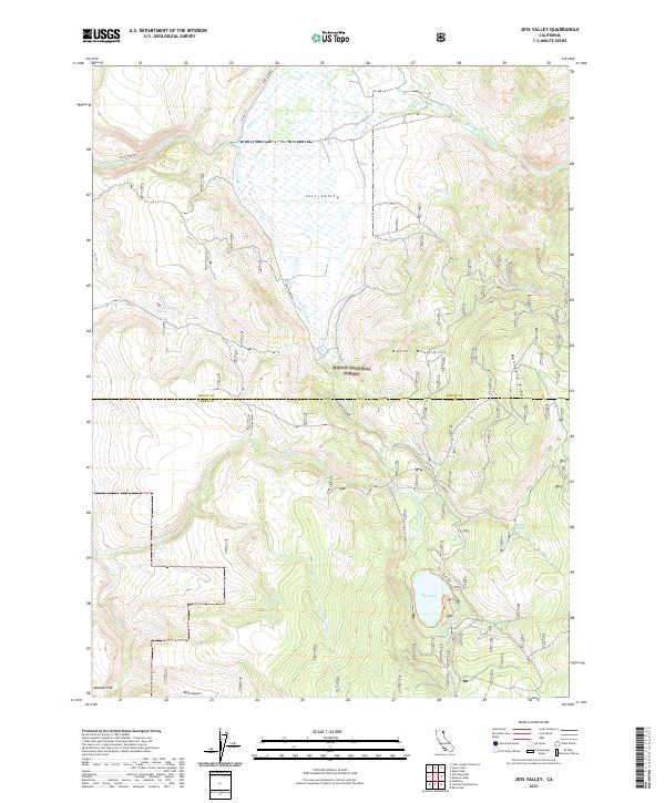
1962 Jess Valley
Modoc County, CA
1962 Snake Lake
Modoc County, CA
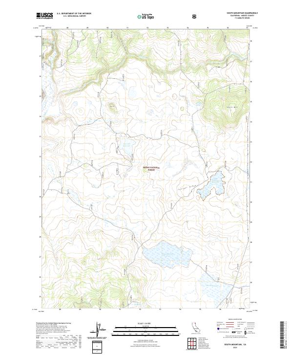
1962 South Mountain
Modoc County, CA
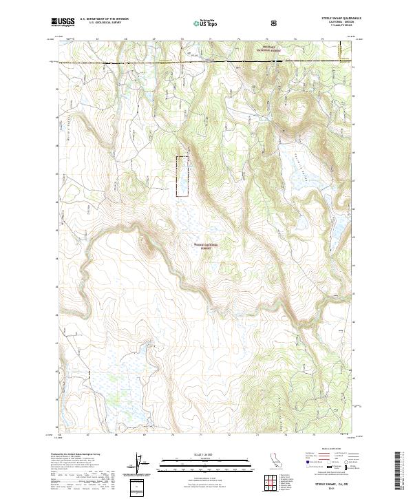
1962 Steele Swamp
Modoc County, CA
1962 Tule Mountain
Modoc County, CA
1962 Whitehorse
Modoc County, CA
1962 Willow Ranch
Modoc County, CA
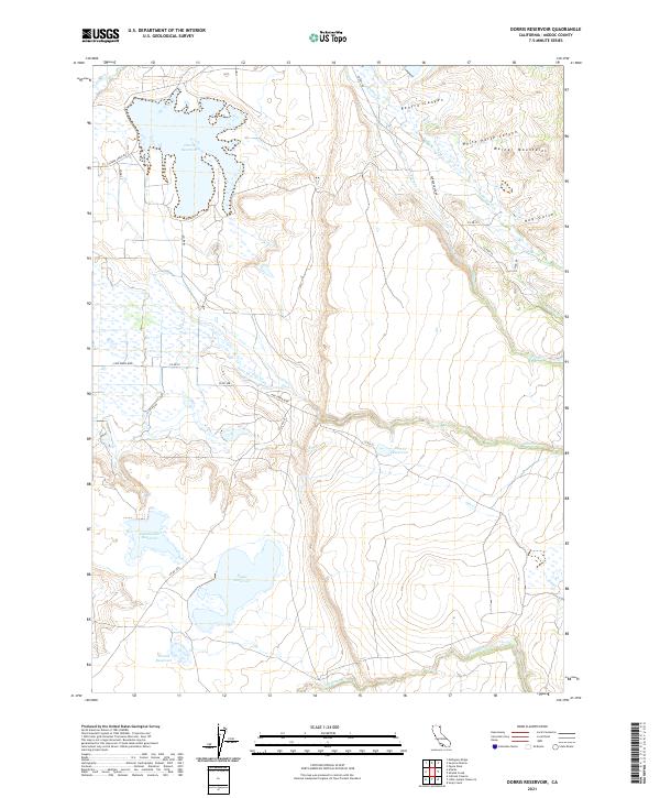
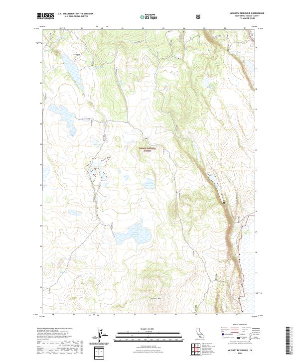
1963 Dorris Reservoir
Modoc County, CA
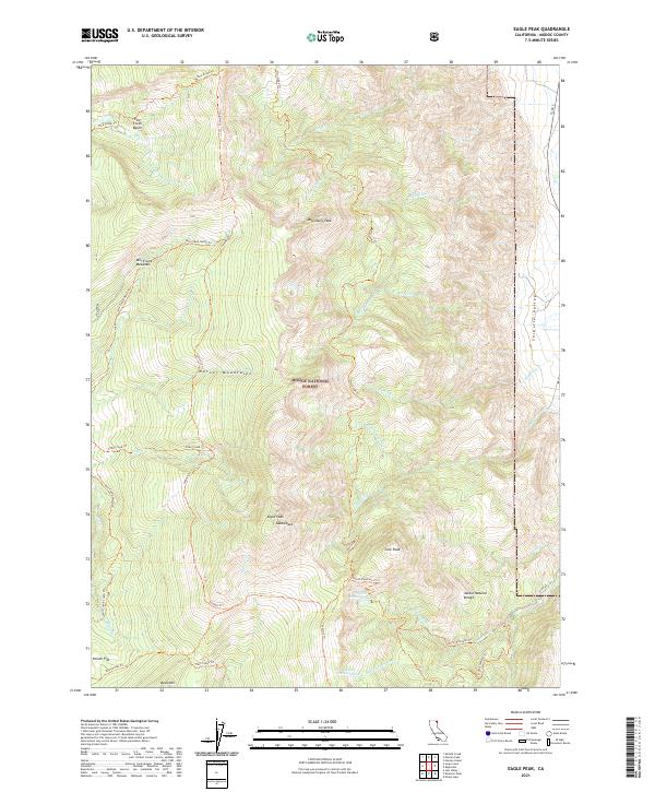
1963 Eagle Peak
Modoc County, CA
1963 Hansen Island
Modoc County, CA
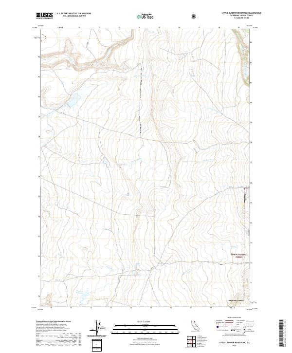
1963 Little Juniper Reservoir
Modoc County, CA
1963 Shields Creek
Modoc County, CA
1963 Soup Creek
Modoc County, CA
1963 Warren Peak
Modoc County, CA
1975 Alturas NE
Modoc County, CA
1988 Caldwell Butte
Modoc County, CA
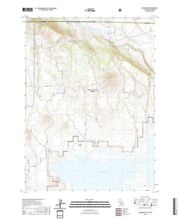
1988 Carr Butte
Modoc County, CA
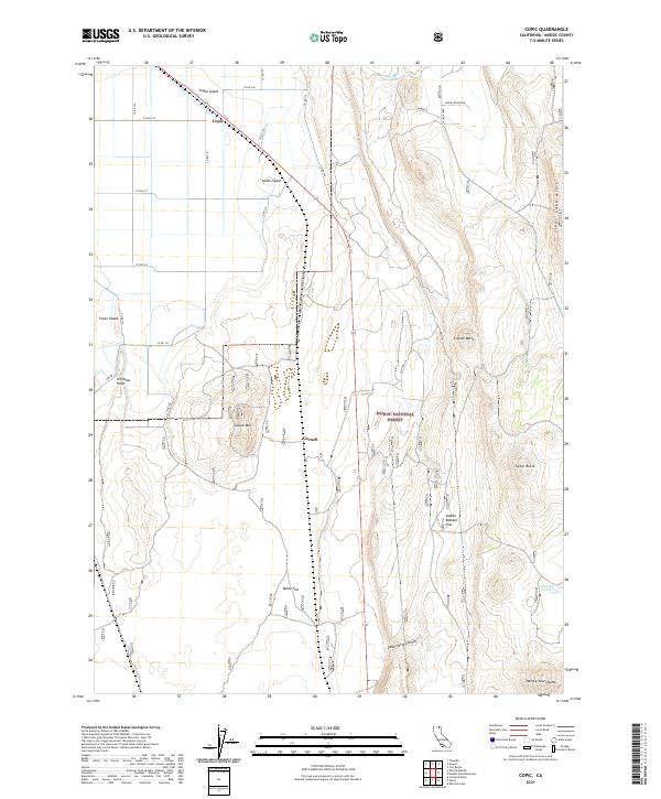
1988 Copic
Modoc County, CA
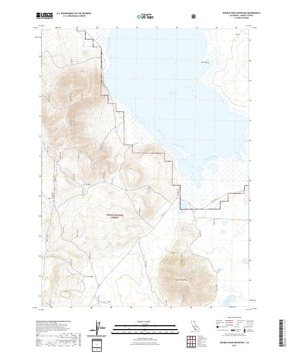
1988 Double Head Mtn
Modoc County, CA
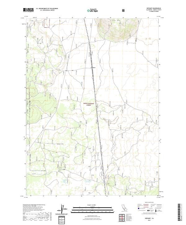
1988 Kephart
Modoc County, CA
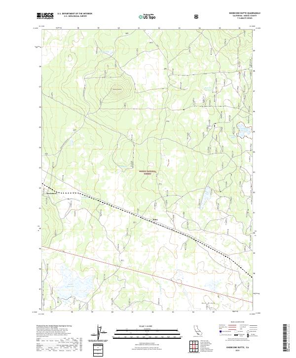
1988 Knobcone Butte
Modoc County, CA
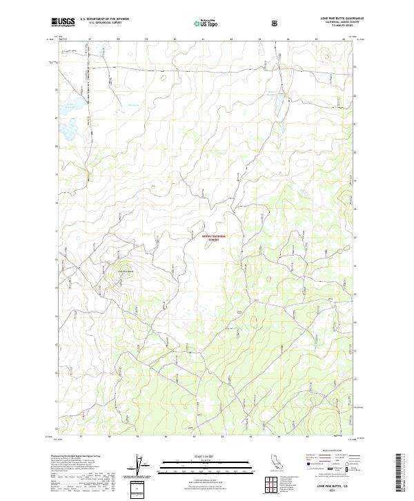
1988 Lone Pine Butte
Modoc County, CA
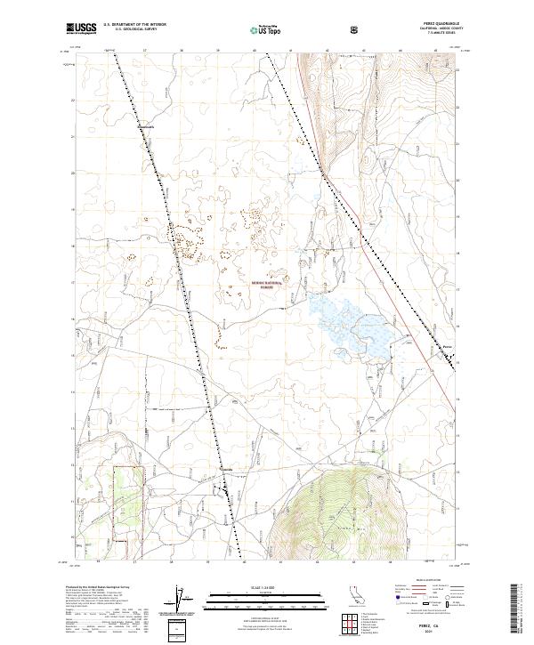
1988 Perez
Modoc County, CA
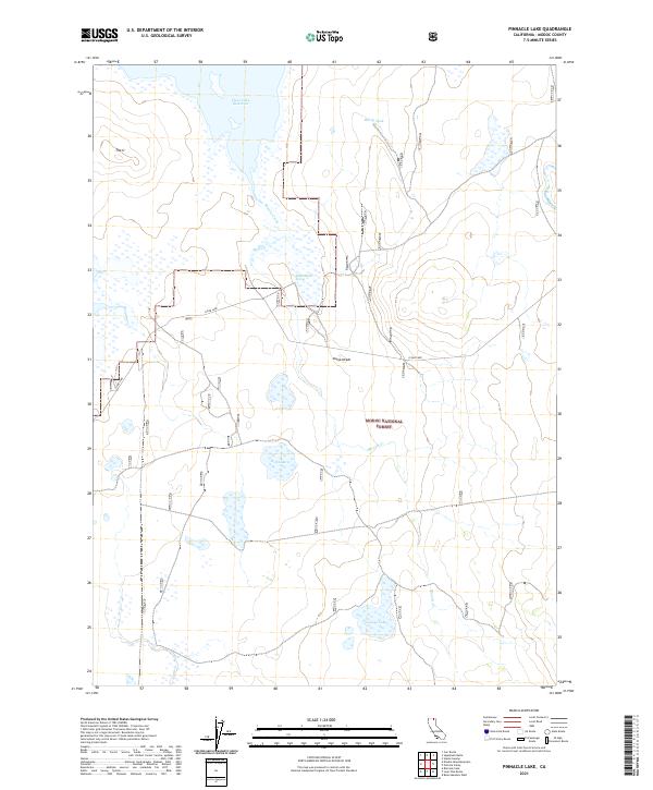
1988 Pinnacle Lake
Modoc County, CA
1988 Rimrock Lake
Modoc County, CA
1988 Sagebrush Butte
Modoc County, CA
1988 Spaulding Butte
Modoc County, CA
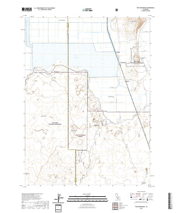
1988 The Panhandle
Modoc County, CA
1988 West of Kephart
Modoc County, CA
1990 Adin Pass
Modoc County, CA
1990 Ambrose
Modoc County, CA
1990 Ambrose Valley
Modoc County, CA
1990 Beaver Mountain
Modoc County, CA
1990 Big Sage Reservoir
Modoc County, CA
1990 Big Swamp
Modoc County, CA
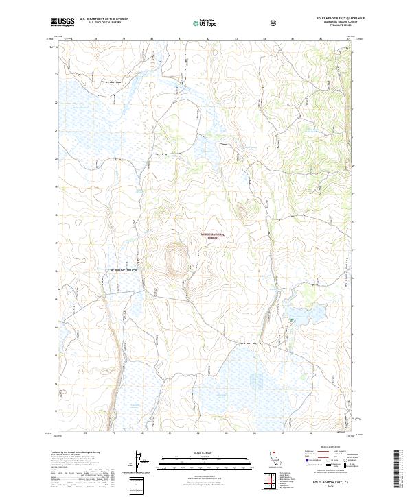
1990 Boles Meadow East
Modoc County, CA
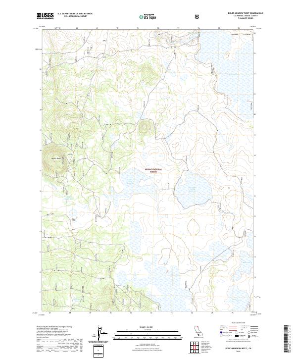
1990 Boles Meadow West
Modoc County, CA
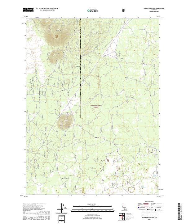
1990 Border Mountain
Modoc County, CA
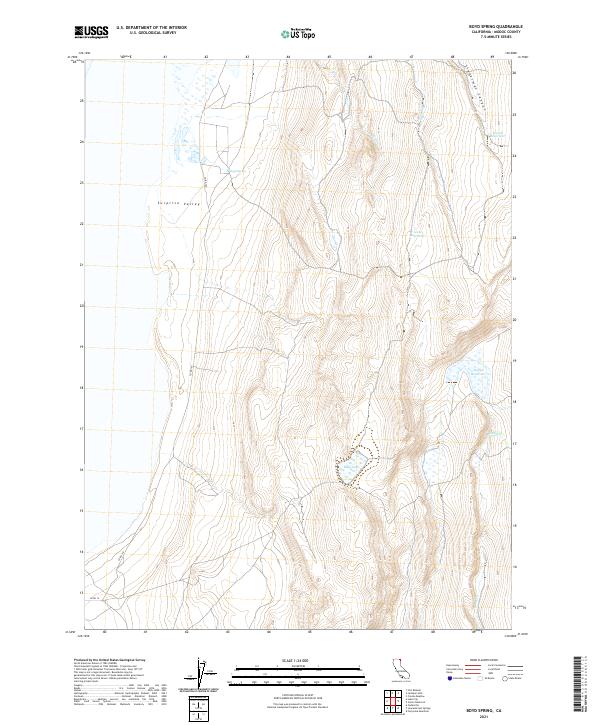
1990 Boyd Spring
Modoc County, CA
1990 Crank Mountain
Modoc County, CA
1990 Davis Creek
Modoc County, CA
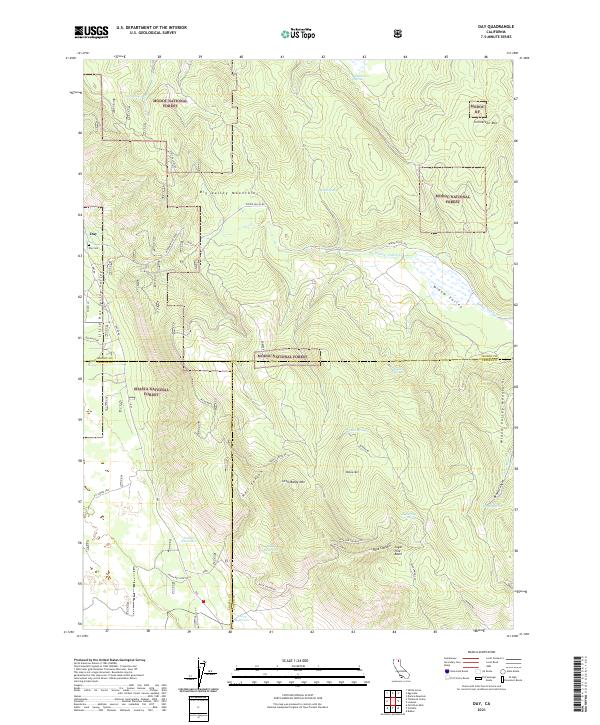
1990 Day
Modoc County, CA
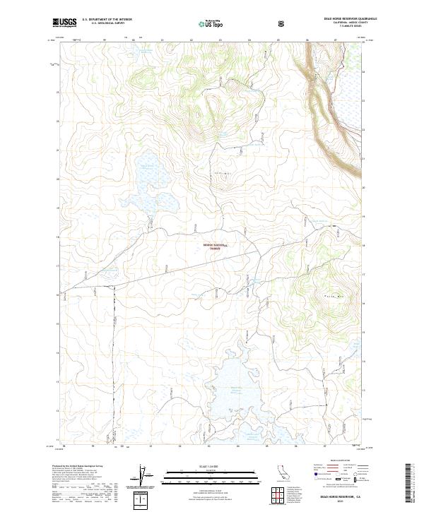
1990 Dead Horse Reservoir
Modoc County, CA
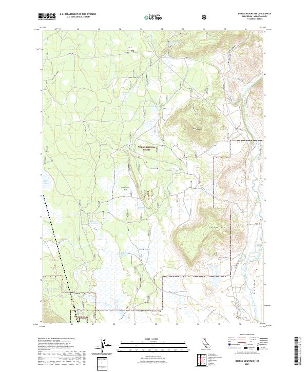
1990 Donica Mountain
Modoc County, CA
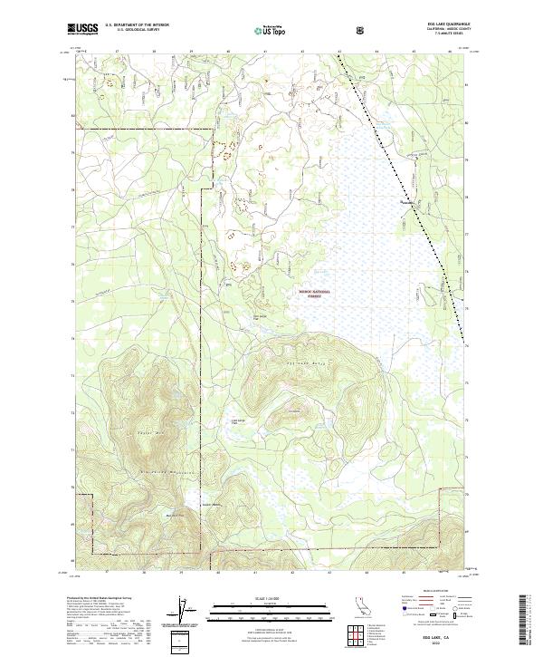
1990 Egg Lake
Modoc County, CA
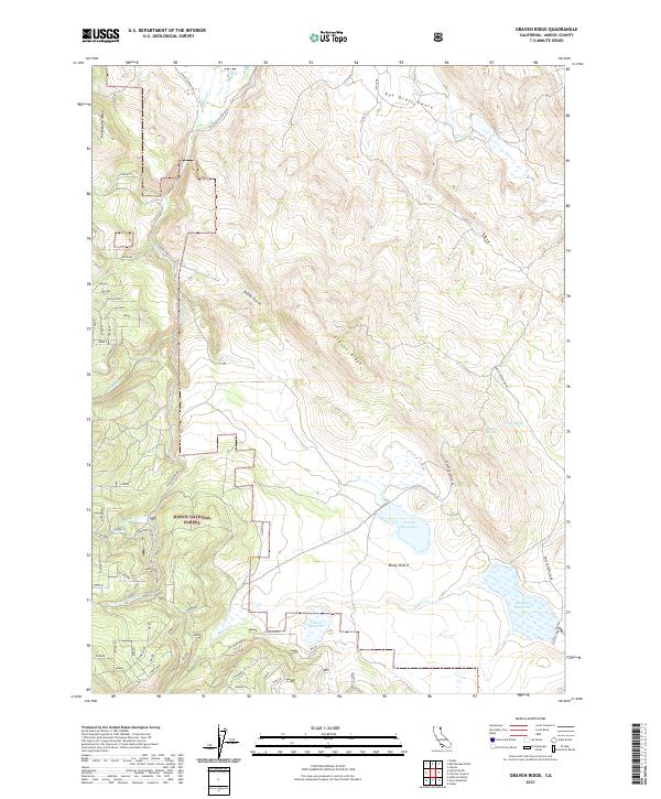
1990 Graven Ridge
Modoc County, CA
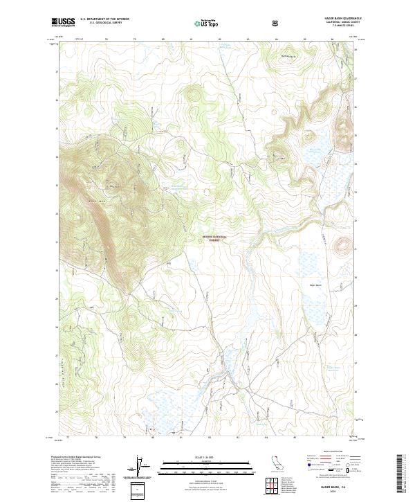
1990 Hager Basin
Modoc County, CA
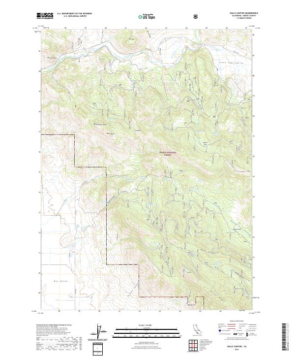
1990 Halls Canyon
Modoc County, CA
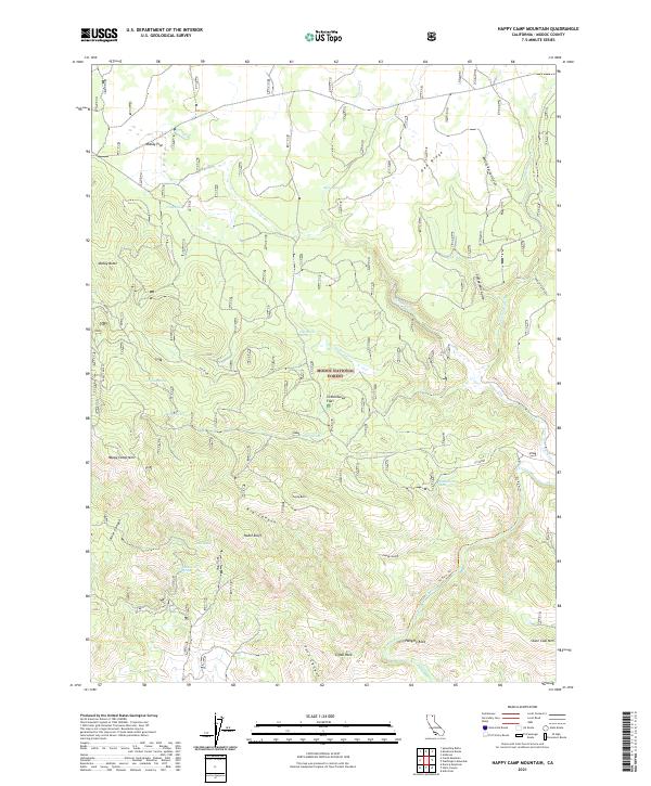
1990 Happy Camp Mountain
Modoc County, CA
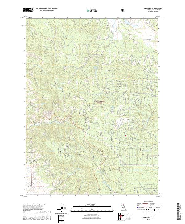
1990 Hermit Butte
Modoc County, CA
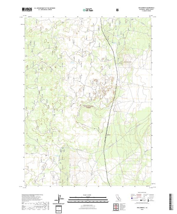
1990 Hollenbeck
Modoc County, CA
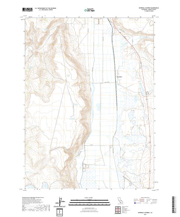
1990 Infernal Caverns
Modoc County, CA
1990 Jacks Butte
Modoc County, CA
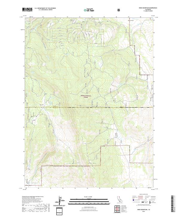
1990 Knox Mountain
Modoc County, CA
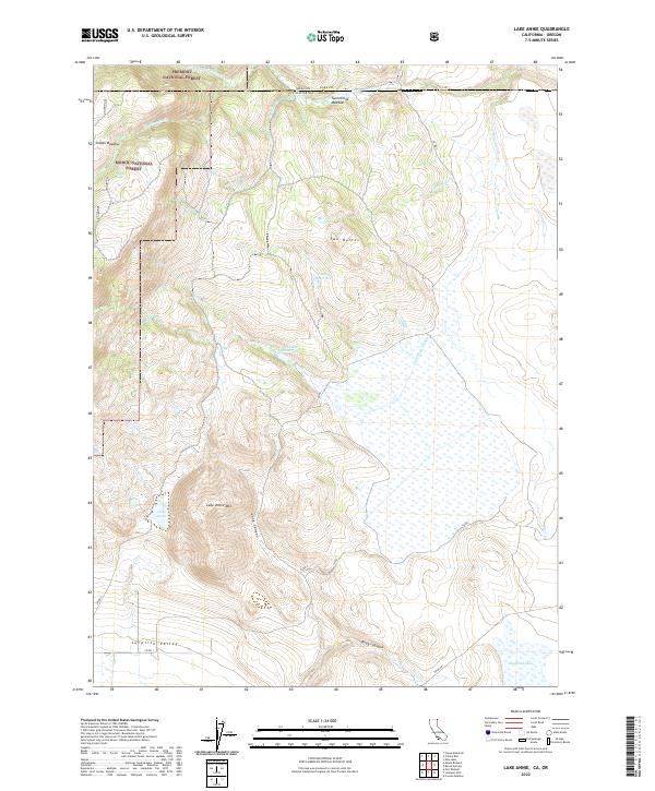
1990 Lake Annie
Modoc County, CA
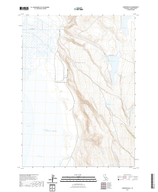
1990 Larkspur Hills
Modoc County, CA
1990 Lauer Reservoir
Modoc County, CA
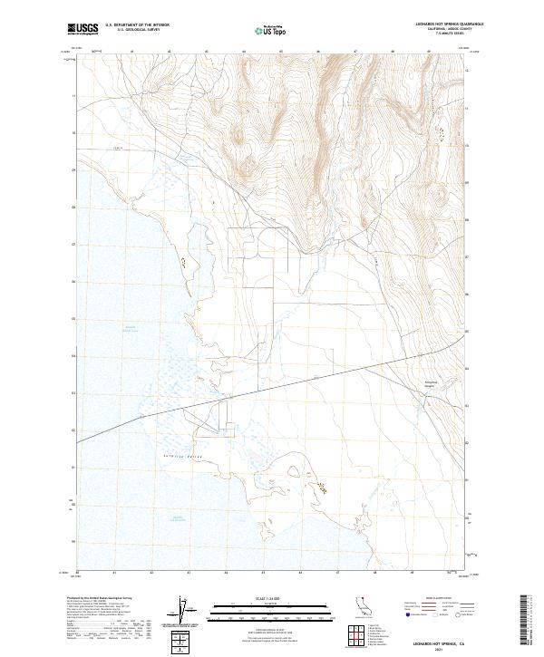
1990 Leonards Hot Springs
Modoc County, CA
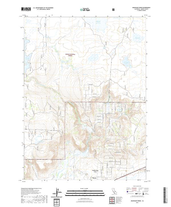
1990 Mahogany Ridge
Modoc County, CA
1990 McGinty Point
Modoc County, CA
1990 Mc Ginty Reservoir
Modoc County, CA
1990 Mount Bidwell
Modoc County, CA
1990 Payne Peak
Modoc County, CA
1990 Pease Flat
Modoc County, CA
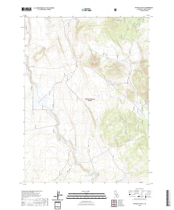
1990 Pothole Valley
Modoc County, CA
1990 Rattlesnake Butte
Modoc County, CA
1990 South Mountain
Modoc County, CA
1990 Steele Swamp
Modoc County, CA

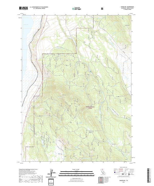
1990 Sugar Hill
Modoc County, CA
1990 Surprise Station
Modoc County, CA
1990 Washington Mountain
Modoc County, CA
1990 Weed Valley
Modoc County, CA
1990 West of Willow Ranch
Modoc County, CA

1990 White Horse
Modoc County, CA
1990 Whittemore Ridge
Modoc County, CA
1990 Willow Ranch
Modoc County, CA

1993 Adin Pass
Modoc County, CA
1993 Ambrose
Modoc County, CA
1993 Ambrose Valley
Modoc County, CA
1993 Beaver Mountain
Modoc County, CA
1993 Big Sage Reservoir
Modoc County, CA
1993 Big Swamp
Modoc County, CA
1993 Boles Meadow East
Modoc County, CA
1993 Boles Meadow West
Modoc County, CA
1993 Border Mountain
Modoc County, CA
1993 Caldwell Butte
Modoc County, CA
1993 Carr Butte
Modoc County, CA
1993 Copic
Modoc County, CA
1993 Crank Mountain
Modoc County, CA
1993 Davis Creek
Modoc County, CA
1993 Dead Horse Reservoir
Modoc County, CA
1993 Donica Mountain
Modoc County, CA
1993 Dorris Reservoir
Modoc County, CA
1993 Double Head Mtn
Modoc County, CA
1993 Eagle Peak
Modoc County, CA
1993 Egg Lake
Modoc County, CA
1993 Emerson Peak
Modoc County, CA
1993 Graven Ridge
Modoc County, CA
1993 Hager Basin
Modoc County, CA
1993 Halls Canyon
Modoc County, CA
1993 Happy Camp Mountain
Modoc County, CA
1993 Hermit Butte
Modoc County, CA
1993 Hollenbeck
Modoc County, CA
1993 Infernal Caverns
Modoc County, CA
1993 Jacks Butte
Modoc County, CA
1993 Jess Valley
Modoc County, CA
1993 Kephart
Modoc County, CA
1993 Knobcone Butte
Modoc County, CA
1993 Knox Mountain
Modoc County, CA
1993 Lake Annie
Modoc County, CA
1993 Lauer Reservoir
Modoc County, CA
1993 Little Juniper Reservoir
Modoc County, CA
1993 Lone Pine Butte
Modoc County, CA
1993 Mahogany Ridge
Modoc County, CA
1993 Mc Ginty Point
Modoc County, CA
1993 Mc Ginty Reservoir
Modoc County, CA
1993 Mount Bidwell
Modoc County, CA
1993 Payne Peak
Modoc County, CA
1993 Pease Flat
Modoc County, CA
1993 Perez
Modoc County, CA
1993 Pinnacle Lake
Modoc County, CA
1993 Pothole Valley
Modoc County, CA
1993 Rattlesnake Butte
Modoc County, CA
1993 Rimrock Lake
Modoc County, CA
1993 Sagebrush Butte
Modoc County, CA
1993 Shields Creek
Modoc County, CA
1993 Snake Lake
Modoc County, CA
1993 Soup Creek
Modoc County, CA
1993 South Mountain
Modoc County, CA
1993 Spaulding Butte
Modoc County, CA
1993 Steele Swamp
Modoc County, CA
1993 Sugar Hill
Modoc County, CA
1993 Surprise Station
Modoc County, CA
1993 The Panhandle
Modoc County, CA
1993 Tule Mountain
Modoc County, CA
1993 Warren Peak
Modoc County, CA

1993 Washington Mountain
Modoc County, CA
1993 Weed Valley
Modoc County, CA
1993 West of Kephart
Modoc County, CA
1993 West of Willow Ranch
Modoc County, CA
1993 White Horse
Modoc County, CA
1993 Whittemore Ridge
Modoc County, CA
1993 Willow Ranch
Modoc County, CA
1995 Day
Modoc County, CA
2012 Adin Pass
Modoc County, CA
2012 Ambrose
Modoc County, CA
2012 Ambrose Valley
Modoc County, CA
2012 Beaver Mountain
Modoc County, CA
2012 Big Sage Reservoir
Modoc County, CA
2012 Big Swamp
Modoc County, CA
2012 Boles Meadow East
Modoc County, CA

2012 Boles Meadow West
Modoc County, CA
2012 Border Mountain
Modoc County, CA
2012 Boyd Spring
Modoc County, CA
2012 Caldwell Butte
Modoc County, CA
2012 Carr Butte
Modoc County, CA
2012 Copic
Modoc County, CA
2012 Crank Mountain
Modoc County, CA
2012 Davis Creek
Modoc County, CA
2012 Day
Modoc County, CA
2012 Dead Horse Reservoir
Modoc County, CA
2012 Donica Mountain
Modoc County, CA
2012 Dorris Reservoir
Modoc County, CA
2012 Double Head Mountain
Modoc County, CA
2012 Eagle Peak
Modoc County, CA
2012 Egg Lake
Modoc County, CA
2012 Emerson Peak
Modoc County, CA
2012 Graven Ridge
Modoc County, CA
2012 Hager Basin
Modoc County, CA
2012 Halls Canyon
Modoc County, CA
2012 Hansen Island
Modoc County, CA
2012 Happy Camp Mountain
Modoc County, CA

2012 Hermit Butte
Modoc County, CA
2012 Hollenbeck
Modoc County, CA
2012 Infernal Caverns
Modoc County, CA
2012 Jacks Butte
Modoc County, CA
2012 Jess Valley
Modoc County, CA
2012 Kephart
Modoc County, CA
2012 Knobcone Butte
Modoc County, CA
2012 Knox Mountain
Modoc County, CA
2012 Lake Annie
Modoc County, CA
2012 Larkspur Hills
Modoc County, CA
2012 Lauer Reservoir
Modoc County, CA
2012 Leonards Hot Springs
Modoc County, CA
2012 Little Juniper Reservoir
Modoc County, CA
2012 Lone Pine Butte
Modoc County, CA
2012 Mahogany Ridge
Modoc County, CA
2012 McGinty Point
Modoc County, CA
2012 McGinty Reservoir
Modoc County, CA
2012 Mount Bidwell
Modoc County, CA
2012 Payne Peak
Modoc County, CA
2012 Pease Flat
Modoc County, CA
2012 Perez
Modoc County, CA
2012 Pinnacle Lake
Modoc County, CA
2012 Pothole Valley
Modoc County, CA
2012 Rattlesnake Butte
Modoc County, CA
2012 Rimrock Lake
Modoc County, CA
2012 Sagebrush Butte
Modoc County, CA
2012 Shields Creek
Modoc County, CA
2012 Snake Lake
Modoc County, CA
2012 Soup Creek
Modoc County, CA
2012 South Mountain
Modoc County, CA
2012 Spaulding Butte
Modoc County, CA
2012 Steele Swamp
Modoc County, CA
2012 Sugar Hill
Modoc County, CA
2012 Surprise Station
Modoc County, CA
2012 The Panhandle
Modoc County, CA
2012 Tule Mountain
Modoc County, CA
2012 Warren Peak
Modoc County, CA
2012 Washington Mountain
Modoc County, CA
2012 Weed Valley
Modoc County, CA

2012 West of Kephart
Modoc County, CA
2012 West of Willow Ranch
Modoc County, CA
2012 White Horse
Modoc County, CA
2012 Whittemore Ridge
Modoc County, CA
2012 Willow Ranch
Modoc County, CA
2015 Adin Pass
Modoc County, CA
2015 Ambrose
Modoc County, CA
2015 Ambrose Valley
Modoc County, CA
2015 Beaver Mountain
Modoc County, CA
2015 Big Sage Reservoir
Modoc County, CA
2015 Big Swamp
Modoc County, CA
2015 Boles Meadow East
Modoc County, CA
2015 Boles Meadow West
Modoc County, CA
2015 Border Mountain
Modoc County, CA
2015 Boyd Spring
Modoc County, CA
2015 Caldwell Butte
Modoc County, CA
2015 Carr Butte
Modoc County, CA
2015 Copic
Modoc County, CA
2015 Crank Mountain
Modoc County, CA
2015 Davis Creek
Modoc County, CA
2015 Day
Modoc County, CA
2015 Dead Horse Reservoir
Modoc County, CA
2015 Donica Mountain
Modoc County, CA
2015 Dorris Reservoir
Modoc County, CA
2015 Double Head Mountain
Modoc County, CA
2015 Eagle Peak
Modoc County, CA
2015 Egg Lake
Modoc County, CA
2015 Emerson Peak
Modoc County, CA
2015 Graven Ridge
Modoc County, CA
2015 Hager Basin
Modoc County, CA
2015 Halls Canyon
Modoc County, CA
2015 Hansen Island
Modoc County, CA
2015 Happy Camp Mountain
Modoc County, CA
2015 Hermit Butte
Modoc County, CA
2015 Hollenbeck
Modoc County, CA
2015 Infernal Caverns
Modoc County, CA
2015 Jacks Butte
Modoc County, CA
2015 Jess Valley
Modoc County, CA
2015 Kephart
Modoc County, CA
2015 Knobcone Butte
Modoc County, CA
2015 Knox Mountain
Modoc County, CA
2015 Lake Annie
Modoc County, CA
2015 Larkspur Hills
Modoc County, CA

2015 Lauer Reservoir
Modoc County, CA
2015 Leonards Hot Springs
Modoc County, CA
2015 Little Juniper Reservoir
Modoc County, CA
2015 Lone Pine Butte
Modoc County, CA
2015 Mahogany Ridge
Modoc County, CA
2015 McGinty Point
Modoc County, CA
2015 McGinty Reservoir
Modoc County, CA
2015 Mount Bidwell
Modoc County, CA
2015 Payne Peak
Modoc County, CA
2015 Pease Flat
Modoc County, CA
2015 Perez
Modoc County, CA
2015 Pinnacle Lake
Modoc County, CA
2015 Pothole Valley
Modoc County, CA
2015 Rattlesnake Butte
Modoc County, CA
2015 Rimrock Lake
Modoc County, CA
2015 Sagebrush Butte
Modoc County, CA
2015 Shields Creek
Modoc County, CA
2015 Snake Lake
Modoc County, CA
2015 Soup Creek
Modoc County, CA
2015 South Mountain
Modoc County, CA
2015 Spaulding Butte
Modoc County, CA
2015 Steele Swamp
Modoc County, CA
2015 Sugar Hill
Modoc County, CA
2015 Surprise Station
Modoc County, CA
2015 The Panhandle
Modoc County, CA
2015 Tule Mountain
Modoc County, CA
2015 Warren Peak
Modoc County, CA
2015 Washington Mountain
Modoc County, CA
2015 Weed Valley
Modoc County, CA
2015 West of Kephart
Modoc County, CA
2015 West of Willow Ranch
Modoc County, CA
2015 White Horse
Modoc County, CA
2015 Whittemore Ridge
Modoc County, CA
2015 Willow Ranch
Modoc County, CA
2018 Adin Pass
Modoc County, CA
2018 Ambrose
Modoc County, CA
2018 Ambrose Valley
Modoc County, CA
2018 Beaver Mountain
Modoc County, CA
2018 Big Sage Reservoir
Modoc County, CA
2018 Big Swamp
Modoc County, CA
2018 Boles Meadow East
Modoc County, CA
2018 Boles Meadow West
Modoc County, CA
2018 Border Mountain
Modoc County, CA
2018 Boyd Spring
Modoc County, CA
2018 Caldwell Butte
Modoc County, CA
2018 Carr Butte
Modoc County, CA
2018 Copic
Modoc County, CA
2018 Crank Mountain
Modoc County, CA
2018 Davis Creek
Modoc County, CA
2018 Day
Modoc County, CA
2018 Dead Horse Reservoir
Modoc County, CA
2018 Donica Mountain
Modoc County, CA
2018 Dorris Reservoir
Modoc County, CA
2018 Double Head Mountain
Modoc County, CA
2018 Eagle Peak
Modoc County, CA
2018 Egg Lake
Modoc County, CA
2018 Emerson Peak
Modoc County, CA
2018 Graven Ridge
Modoc County, CA
2018 Hager Basin
Modoc County, CA
2018 Halls Canyon
Modoc County, CA
2018 Hansen Island
Modoc County, CA
2018 Happy Camp Mountain
Modoc County, CA
2018 Hermit Butte
Modoc County, CA
2018 Hollenbeck
Modoc County, CA
2018 Infernal Caverns
Modoc County, CA
2018 Jacks Butte
Modoc County, CA
2018 Jess Valley
Modoc County, CA

2018 Kephart
Modoc County, CA
2018 Knobcone Butte
Modoc County, CA
2018 Knox Mountain
Modoc County, CA
2018 Lake Annie
Modoc County, CA
2018 Larkspur Hills
Modoc County, CA
2018 Lauer Reservoir
Modoc County, CA
2018 Leonards Hot Springs
Modoc County, CA
2018 Little Juniper Reservoir
Modoc County, CA
2018 Lone Pine Butte
Modoc County, CA

2018 Mahogany Ridge
Modoc County, CA
2018 McGinty Point
Modoc County, CA
2018 McGinty Reservoir
Modoc County, CA
2018 Mount Bidwell
Modoc County, CA
2018 Payne Peak
Modoc County, CA
2018 Pease Flat
Modoc County, CA
2018 Perez
Modoc County, CA
2018 Pinnacle Lake
Modoc County, CA
2018 Pothole Valley
Modoc County, CA

2018 Rattlesnake Butte
Modoc County, CA
2018 Rimrock Lake
Modoc County, CA
2018 Sagebrush Butte
Modoc County, CA
2018 Shields Creek
Modoc County, CA
2018 Snake Lake
Modoc County, CA
2018 Soup Creek
Modoc County, CA
2018 South Mountain
Modoc County, CA
2018 Spaulding Butte
Modoc County, CA
2018 Steele Swamp
Modoc County, CA
2018 Sugar Hill
Modoc County, CA
2018 Surprise Station
Modoc County, CA
2018 The Panhandle
Modoc County, CA
2018 Tule Mountain
Modoc County, CA
2018 Warren Peak
Modoc County, CA
2018 Washington Mountain
Modoc County, CA
2018 Weed Valley
Modoc County, CA
2018 West of Kephart
Modoc County, CA
2018 West of Willow Ranch
Modoc County, CA
2018 White Horse
Modoc County, CA
2018 Whittemore Ridge
Modoc County, CA
2018 Willow Ranch
Modoc County, CA
2021 Ambrose Valley
Modoc County, CA
2021 Big Sage Reservoir
Modoc County, CA
2021 Boles Meadow East
Modoc County, CA
2021 Boles Meadow West
Modoc County, CA
2021 Border Mountain
Modoc County, CA
2021 Boyd Spring
Modoc County, CA
2021 Caldwell Butte
Modoc County, CA
2021 Copic
Modoc County, CA
2021 Crank Mountain
Modoc County, CA
2021 Davis Creek
Modoc County, CA
2021 Day
Modoc County, CA
2021 Dead Horse Reservoir
Modoc County, CA
2021 Donica Mountain
Modoc County, CA
2021 Dorris Reservoir
Modoc County, CA
2021 Double Head Mountain
Modoc County, CA
2021 Eagle Peak
Modoc County, CA
2021 Emerson Peak
Modoc County, CA
2021 Graven Ridge
Modoc County, CA
2021 Hager Basin
Modoc County, CA
2021 Halls Canyon
Modoc County, CA
2021 Hansen Island
Modoc County, CA
2021 Happy Camp Mountain
Modoc County, CA
2021 Hermit Butte
Modoc County, CA
2021 Infernal Caverns
Modoc County, CA
2021 Jacks Butte
Modoc County, CA
2021 Jess Valley
Modoc County, CA
2021 Kephart
Modoc County, CA
2021 Knobcone Butte
Modoc County, CA
2021 Knox Mountain
Modoc County, CA
2021 Larkspur Hills
Modoc County, CA
2021 Leonards Hot Springs
Modoc County, CA
2021 Little Juniper Reservoir
Modoc County, CA
2021 Lone Pine Butte
Modoc County, CA
2021 Mahogany Ridge
Modoc County, CA
2021 McGinty Reservoir
Modoc County, CA
2021 Perez
Modoc County, CA
2021 Pinnacle Lake
Modoc County, CA
2021 Pothole Valley
Modoc County, CA
2021 Rattlesnake Butte
Modoc County, CA
2021 Rimrock Lake
Modoc County, CA
2021 Sagebrush Butte
Modoc County, CA
2021 Shields Creek
Modoc County, CA
2021 South Mountain
Modoc County, CA
2021 Steele Swamp
Modoc County, CA
2021 Sugar Hill
Modoc County, CA
2021 The Panhandle
Modoc County, CA
2021 Warren Peak
Modoc County, CA
2021 Weed Valley
Modoc County, CA
2021 West of Willow Ranch
Modoc County, CA
2021 Whittemore Ridge
Modoc County, CA
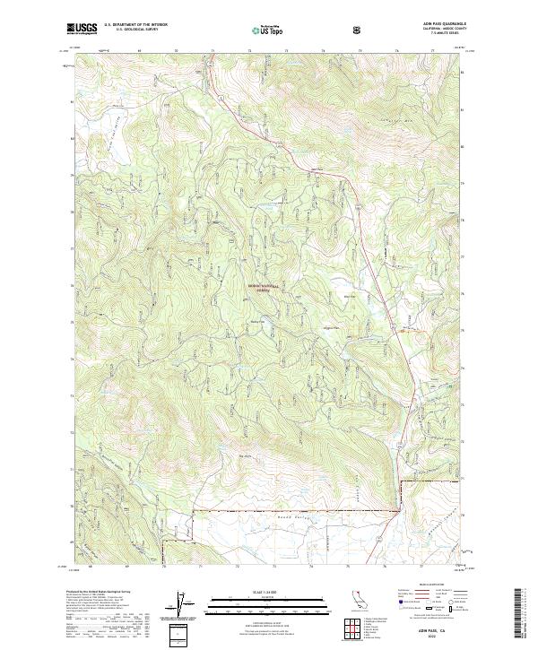
2022 Adin Pass
Modoc County, CA
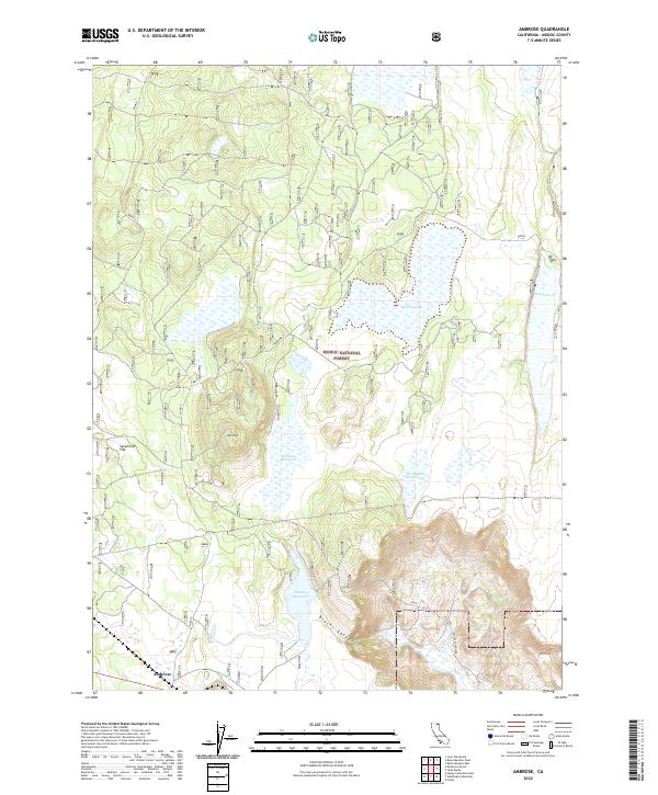
2022 Ambrose
Modoc County, CA
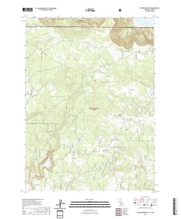
2022 Beaver Mountain
Modoc County, CA
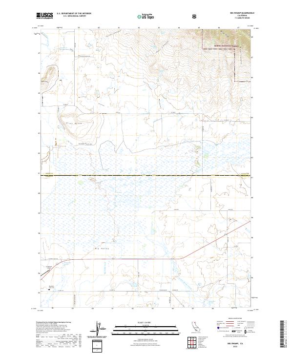
2022 Big Swamp
Modoc County, CA
2022 Carr Butte
Modoc County, CA
2022 Egg Lake
Modoc County, CA
2022 Hollenbeck
Modoc County, CA
2022 Lake Annie
Modoc County, CA
2022 Lauer Reservoir
Modoc County, CA
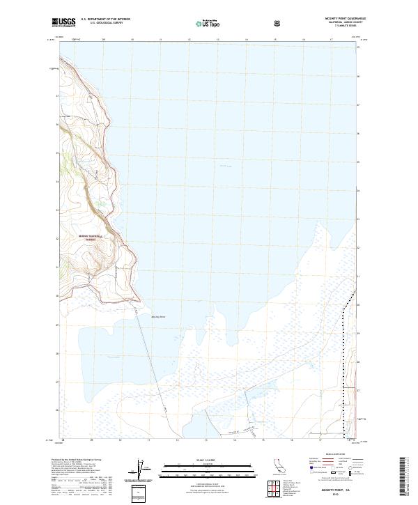
2022 McGinty Point
Modoc County, CA
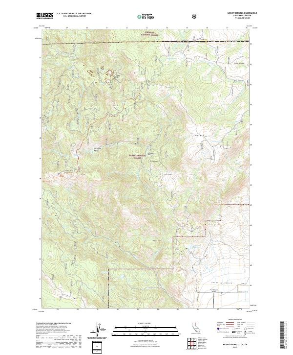
2022 Mount Bidwell
Modoc County, CA
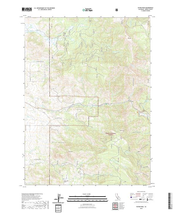
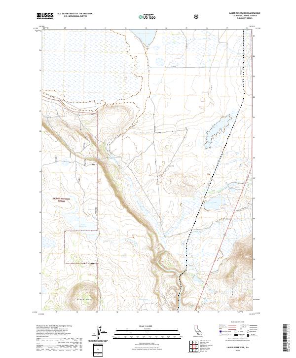
2022 Payne Peak
Modoc County, CA
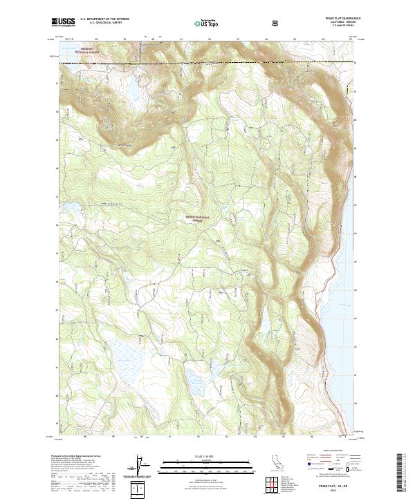
2022 Pease Flat
Modoc County, CA
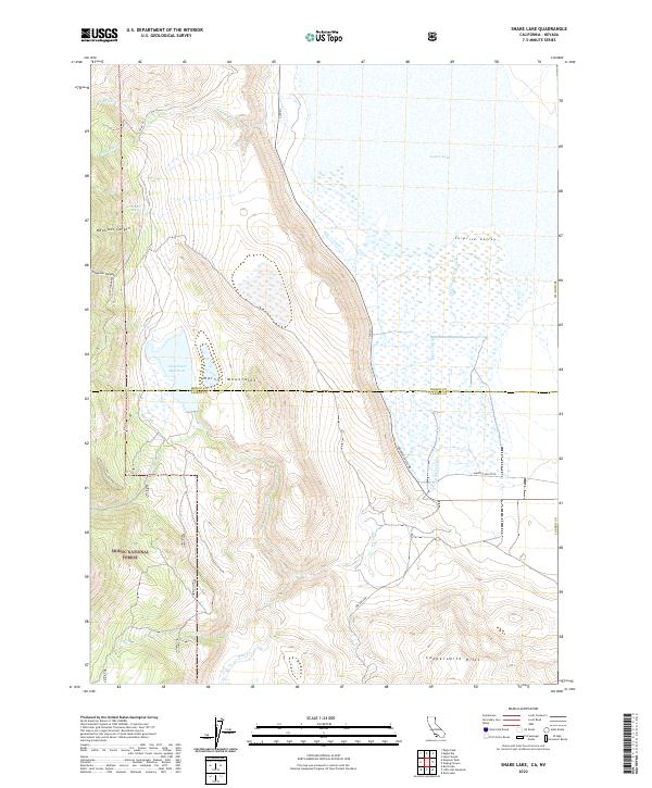
2022 Snake Lake
Modoc County, CA
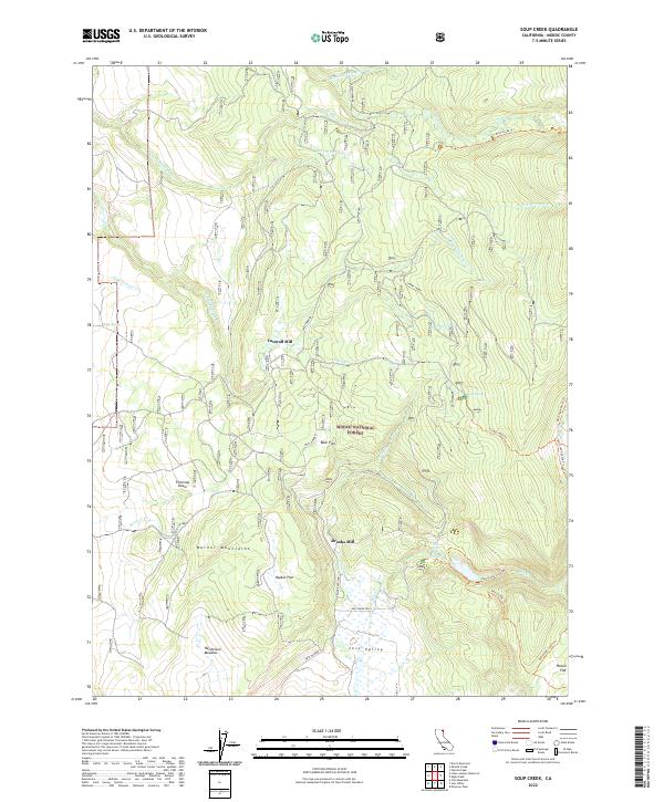
2022 Soup Creek
Modoc County, CA
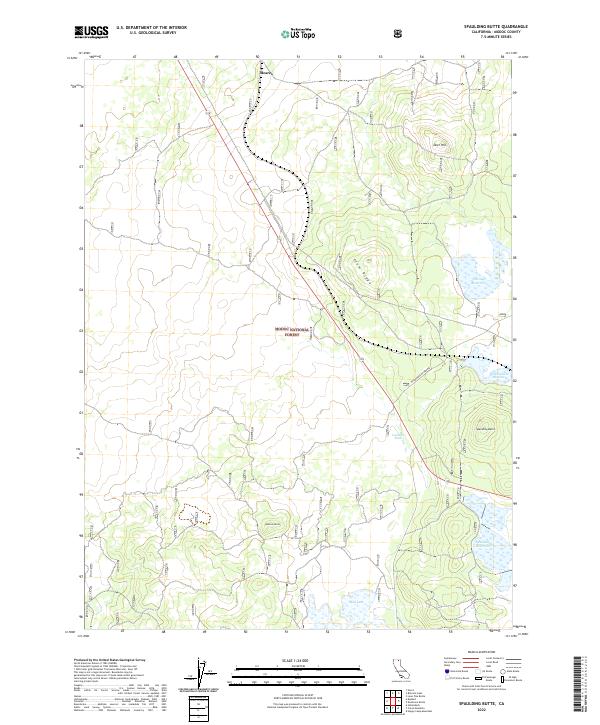
2022 Spaulding Butte
Modoc County, CA
2022 Surprise Station
Modoc County, CA
2022 Tule Mountain
Modoc County, CA
2022 Washington Mountain
Modoc County, CA
2022 West of Kephart
Modoc County, CA
2022 White Horse
Modoc County, CA
2022 Willow Ranch
Modoc County, CA
2023 Warren Peak
Modoc County, CA