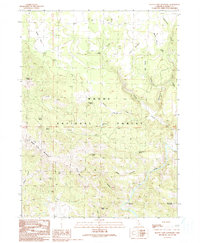
1990 Map of Happy Camp Mountain
USGS Topo · Published 1990About this map
The Modoc National Forest landscape shown here is defined by high-elevation volcanic landforms and a series of perennial water sources essential for high-country activity. The map centers on the namesake Happy Camp Mountain, with the topography falling away toward the Pit River in the southeast. Cultural markers of previous activity and seasonal use are scattered throughout the forest, notably the Old Hulbert Place and Geng Camp. Numerous springs, including Bark Spring, Log Corral Spring, and Yellowjacket Spring, provide a vital network of water points across the drainages. Distinctive landmarks such as McKay Butte, Cuppy Butte, and Stone Coal Mountain punctuate the ridges, while features like Hanging Rock and Signal Rock indicate prominent lookout points overlooking Post Canyon.
Find a feature on this map
34 named features on this map. Tap any name to fly to it.
Don’t see what you’re looking for? This feature index may not catch every label — zoom into the map to look around manually.
Map Details
Editions of this 1990 Happy Camp Mountain Map
This is the sole edition of this map. No revisions or reprints were ever made.
Other maps of this area

1886 · Alturas
USGS Topo · 1:250,000

1886 · Modoc Lava Bed
USGS Topo · 1:250,000

1892 · Modoc Lava-Bed
USGS Topo · 1:250,000

1892 · Alturas
USGS Topo · 1:250,000

1952 · Hackamore
USGS Topo · 1:62,500

1954 · Alturas
USGS Topo · 1:250,000

1958 · Alturas
USGS Topo · 1:250,000

1961 · Canby
USGS Topo · 1:62,500

1962 · Alturas
USGS Topo · 1:250,000

1962 · Crank Mountain
USGS Topo · 1:62,500