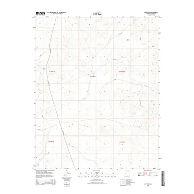
2014 Map of Hard Rocks
USGS Topo · Published 2014About this map
Hard Rocks sits at the center of this 2014 survey, illustrating a landscape defined by intermittent watercourses and traditional high-desert travel routes. The drainage of Oraibi Wash cuts through the southwestern corner, a vital geographical marker in this arid region of the Navajo Nation. The terrain is marked by significant landforms such as White Valley and Ah Na Na Betoh, with elevations rising toward the north. Transportation is a mix of established Bureau of Indian Affairs routes and named local paths, including the distinctive Turquoise Trl and Vetro Rd. These roads often follow the natural contours of the mesas, connecting isolated homesteads and grazing lands. The map provides a precise look at the township and range divisions across T31N and T30N, documenting the modern infrastructure of this rural interior.
Find a feature on this map
19 named features on this map. Tap any name to fly to it.
Don’t see what you’re looking for? This feature index may not catch every label — zoom into the map to look around manually.
Map Details
Editions of this 2014 Hard Rocks Map
This is the sole edition of this map. No revisions or reprints were ever made.
Other maps of this area

1883 · Marsh Pass
USGS Topo · 1:250,000

1883 · Tusayan
USGS Topo · 1:250,000

1886 · Tusayan
USGS Topo · 1:250,000

1892 · Marsh Pass
USGS Topo · 1:250,000

1947 · Flagstaff
USGS Topo · 1:250,000

1954 · Flagstaff
USGS Topo · 1:250,000

1956 · Marble Canyon
USGS Topo · 1:250,000

1958 · Flagstaff
USGS Topo · 1:250,000

1959 · Marble Canyon
USGS Topo · 1:250,000

1960 · Flagstaff
USGS Topo · 1:250,000