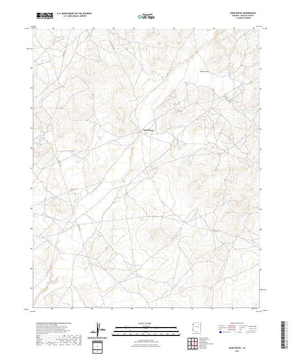
2021 Map of Hard Rocks
USGS Topo · Published 2021About this map
Hard Rocks and White Valley anchor this remote landscape in Navajo County, defined by a sparse network of roads that traverse the high plateau. The map details a transition between township boundaries like t31n r17e and t31n r18e, where the terrain is marked by intricate contour lines and seasonal water features. A primary hydrologic point of interest is Ah Na Na Betoh, located in the northeastern quadrant near the intersection of several local routes. The transportation network is dominated by tribal and local designations, including the Turquoise Trl and Indian Rte 8031, which connect the small settlements across the high desert floor. This 2021 survey reflects the modern management of these traditional lands, preserving the specific nomenclature of the region's geography and infrastructure.
Find a feature on this map
14 named features on this map. Tap any name to fly to it.
Don’t see what you’re looking for? This feature index may not catch every label — zoom into the map to look around manually.
Map Details
Editions of this 2021 Hard Rocks Map
This is the sole edition of this map. No revisions or reprints were ever made.
Other maps of this area

1883 · Marsh Pass
USGS Topo · 1:250,000

1883 · Tusayan
USGS Topo · 1:250,000

1886 · Tusayan
USGS Topo · 1:250,000

1892 · Marsh Pass
USGS Topo · 1:250,000

1947 · Flagstaff
USGS Topo · 1:250,000

1954 · Flagstaff
USGS Topo · 1:250,000

1956 · Marble Canyon
USGS Topo · 1:250,000

1958 · Flagstaff
USGS Topo · 1:250,000

1959 · Marble Canyon
USGS Topo · 1:250,000

1960 · Flagstaff
USGS Topo · 1:250,000