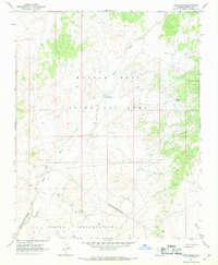
1967 Map of Hard Rocks
USGS Topo · Published 1969About this map
Oraibi Wash meanders across this high desert landscape, serving as a primary geographic artery through the Navajo Hopi Joint Use Area during the late 1960s. The settlement at Hard Rocks and the nearby Hard Rocks Dam reflect the localized efforts to manage water resources and establish permanent habitations in this arid region of Navajo County. This survey illustrates a complex layer of administrative and tribal history, clearly delineating the Joint Use Area and Indian Reservation boundaries. Notable landmarks like Ah Na Na Betoh and Tsi Tai De Linne provide specific geographic anchors for researchers studying the cultural landscape, while the topography of White Valley in the northeast corner highlights the distinct landforms that define the transition between tribal lands.
Find a feature on this map
11 named features on this map. Tap any name to fly to it.
Don’t see what you’re looking for? This feature index may not catch every label — zoom into the map to look around manually.
Map Details
Editions of this 1967 Hard Rocks Map
This is the sole edition of this map. No revisions or reprints were ever made.
Other maps of this area

1883 · Marsh Pass
USGS Topo · 1:250,000

1883 · Tusayan
USGS Topo · 1:250,000

1886 · Tusayan
USGS Topo · 1:250,000

1892 · Marsh Pass
USGS Topo · 1:250,000

1947 · Flagstaff
USGS Topo · 1:250,000

1954 · Flagstaff
USGS Topo · 1:250,000

1956 · Marble Canyon
USGS Topo · 1:250,000

1958 · Flagstaff
USGS Topo · 1:250,000

1959 · Marble Canyon
USGS Topo · 1:250,000

1960 · Flagstaff
USGS Topo · 1:250,000