Loading...
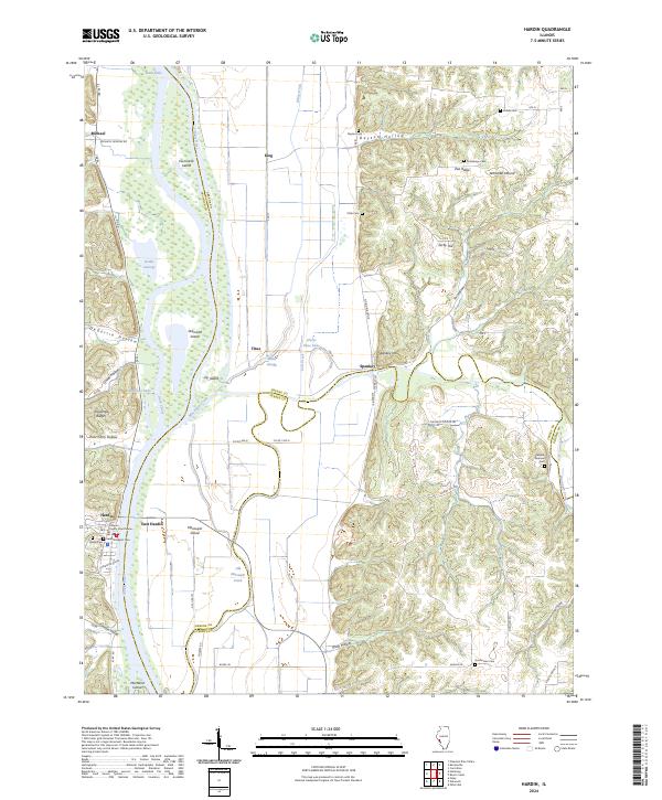
Loading map...2024 Map of Hardin
USGS Topo · Published 2024About this map
Hardin stands as the primary seat of activity on this sheet, situated on the western bank of the Illinois River. The town is anchored by the Calhoun County Courthouse and historical religious sites like Saint Norberts Cem. Across the water, East Hardin and Macoupin Island signify the river's central role in the regional geography, where the main channel meets complex waterways including Dark Chute and Macoupin Creek.
Find a feature on this map
63 named features on this map. Tap any name to fly to it.
Don’t see what you’re looking for? This feature index may not catch every label — zoom into the map to look around manually.
Map Details
Date Portrayed2024
Date Published2024
PublisherU.S. Geological Survey
Map TypeTopographic
Scale1:24000
Physical Dimensions24 x 29 inches
Editions of this 2024 Hardin Map
This is the sole edition of this map. No revisions or reprints were ever made.
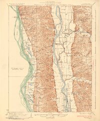
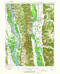
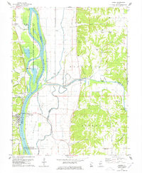
Historical Maps of King Through Time
5 maps found

Featured Locations
Source Details
SourceU.S. Geological Survey
CopyrightPublic Domain