
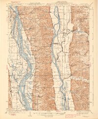
1938 Map of Hardin
USGS Topo · Published 1938About this map
Hardin stands as the central hub of this riverine landscape, where the Illinois River and Mississippi River converge toward their junction. Surveyed in the late 1920s and mid-1930s, the map reveals a complex network of chutes, islands, and backwater lakes that defined life in Calhoun County before modern levee systems fully transformed the bottoms. The interior ridges are dotted with country institutions like the Poor Farm and Gilead Cemetery, while the riverbanks are marked by historic points of transit such as Sterling Landing and Wilson Landing.
Find a feature on this map
87 named features on this map. Tap any name to fly to it.
Don’t see what you’re looking for? This feature index may not catch every label — zoom into the map to look around manually.
Map Details
Editions of this 1938 Hardin Map
2 editions found
Other maps of this area

1903 · O'Fallon
USGS Topo · 1:125,000

1924 · Roodhouse
USGS Topo · 1:62,500

1926 · Roodhouse
USGS Topo · 1:62,500

1927 · St. Charles
USGS Topo · 1:62,500

1930 · Pearl
USGS Topo · 1:62,500

1930 · Nebo
USGS Topo · 1:62,500

1930 · Hardin
USGS Topo · 1:62,500

1930 · Jerseyville
USGS Topo · 1:62,500

1931 · Brussels
USGS Topo · 1:62,500

1933 · Jerseyville
USGS Topo · 1:62,500