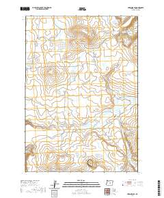
2020 Map of Hardin Ranch
USGS Topo · Published 2020About this map
Hardin Ranch stands as a primary point of human settlement in this high-desert landscape of Crook County. The terrain is characterized by a network of seasonal water sources and distinct geological elevations, including the prominent Sherman Rim and the volcanic profiles of Grass Butte and Magpie Butte. A heavy reliance on managed water for ranching and livestock is evident through numerous named catchments such as Ryegrass Reservoir, Thumbtack Reservoir, and the uniquely named Eowyn Reservoir.
Find a feature on this map
24 named features on this map. Tap any name to fly to it.
Don’t see what you’re looking for? This feature index may not catch every label — zoom into the map to look around manually.
Map Details
Editions of this 2020 Hardin Ranch Map
This is the sole edition of this map. No revisions or reprints were ever made.
Other maps of this area

1932 · Dayville
USGS Topo · 1:125,000

1936 · Dayville
USGS Topo · 1:125,000

1955 · Crescent
USGS Topo · 1:250,000

1955 · Bend
USGS Topo · 1:250,000

1955 · Burns
USGS Topo · 1:250,000

1955 · Canyon City
USGS Topo · 1:250,000

1957 · Crescent
USGS Topo · 1:250,000

1957 · Bend
USGS Topo · 1:250,000

1958 · Crescent
USGS Topo · 1:250,000

1958 · Burns
USGS Topo · 1:250,000