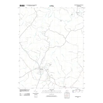
2010 Map of Hardinsburg
USGS Topo · Published 2010About this map
Hardinsburg serves as the central hub of this 2010 topographic study, surrounded by a rural landscape of family-named roads and rolling drainage patterns. The settlement of Codyville sits just east of the town center, while the Breckinridge County Airport occupies the plateau to the north. The area's geography is defined by a dense network of waterways including Sinking Creek and Hardins Creek, which carve through local landmarks like Miller Hollow and Norton Valley. To the northeast, the community of Clifton Mills marks a historic crossing point. The map is particularly useful for local historians, as it meticulously preserves names of rural thoroughfares such as Haynes Cemetery Rd, Freedom Church Rd, and Ephesus Church Rd, indicating the locations of long-standing community institutions and family homesteads near Harned.
Find a feature on this map
45 named features on this map. Tap any name to fly to it.
Don’t see what you’re looking for? This feature index may not catch every label — zoom into the map to look around manually.
Map Details
Editions of this 2010 Hardinsburg Map
This is the sole edition of this map. No revisions or reprints were ever made.
Other maps of this area

1928 · Hardinsburg
USGS Topo · 1:48,000

1931 · Hardinsburg
USGS Topo · 1:62,500

1932 · Fordsville
USGS Topo · 1:62,500

1934 · Cannelton
USGS Topo · 1:62,500

1947 · Irvington
USGS Topo · 1:24,000

1947 · Lodiburg
USGS Topo · 1:24,000

1947 · Hardinsburg
USGS Topo · 1:24,000

1947 · Garfield
USGS Topo · 1:24,000

1947 · Hardinsburg
USGS Topo · 1:62,500

1953 · Custer
USGS Topo · 1:24,000