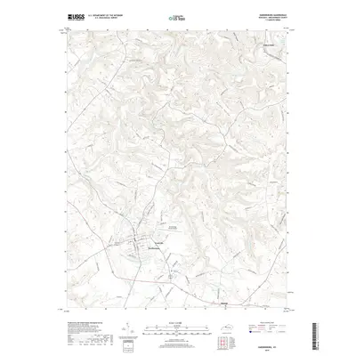
2019 Map of Hardinsburg
USGS Topo · Published 2019About this map
Hardinsburg serves as the focal point of this Kentucky landscape, where the town's street grid transitions into a complex web of rural roads and creek valleys. The topography is defined by significant drainage systems, notably Sinking Creek in the north and the winding Hardins Cr that flows past the western edge of the county seat. These waterways have historically dictated settlement patterns, as seen in the placement of Clifton Mills near the northern border and the small community of Harned to the southeast. Local history is etched into the terrain through family-named landmarks like Norton Valley and several hollows.
Find a feature on this map
73 named features on this map. Tap any name to fly to it.
Don’t see what you’re looking for? This feature index may not catch every label — zoom into the map to look around manually.
Map Details
Editions of this 2019 Hardinsburg Map
This is the sole edition of this map. No revisions or reprints were ever made.
Other maps of this area

1928 · Hardinsburg
USGS Topo · 1:48,000

1931 · Hardinsburg
USGS Topo · 1:62,500

1932 · Fordsville
USGS Topo · 1:62,500

1934 · Cannelton
USGS Topo · 1:62,500

1947 · Irvington
USGS Topo · 1:24,000

1947 · Lodiburg
USGS Topo · 1:24,000

1947 · Hardinsburg
USGS Topo · 1:24,000

1947 · Garfield
USGS Topo · 1:24,000

1947 · Hardinsburg
USGS Topo · 1:62,500

1953 · Custer
USGS Topo · 1:24,000