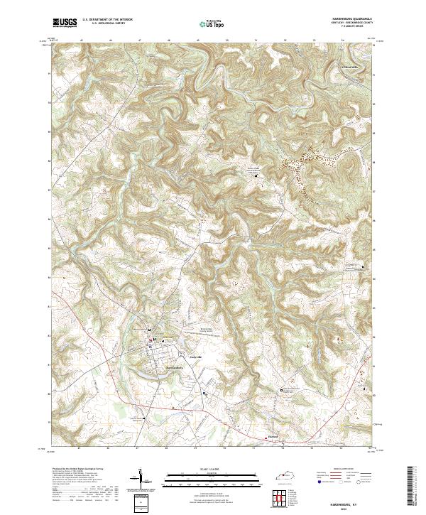
2022 Map of Hardinsburg
USGS Topo · Published 2022About this map
Hardinsburg serves as the focal point of this Breckinridge County landscape, where the local street grid intersects with several primary corridors. The surrounding terrain is defined by a dense network of drainage systems, including the winding course of Sinking Creek to the north and Meadows Cr to the south. The settlement pattern is largely influenced by the deep incisions of Miller Hollow and Norton Valley, forcing roads to follow the high ridgelines between watersheds. Genealogists will find a significant density of burial sites across the quadrangle, ranging from the large Hardinsburg Cem and Ivy Hill Cem near the town center to more secluded locations like the John De Haven Family Cem. In the outlying areas, small communities such as Codyville, Harned, and Clifton Mills illustrate the historical importance of localized centers near water sources like Boiling Springs. The presence of the Breckinridge County Airport and churches such as Horsley Chapel United Methodist Church highlight the area's modern infrastructure and established social hubs.
Find a feature on this map
90 named features on this map. Tap any name to fly to it.
Don’t see what you’re looking for? This feature index may not catch every label — zoom into the map to look around manually.
Map Details
Editions of this 2022 Hardinsburg Map
This is the sole edition of this map. No revisions or reprints were ever made.
Other maps of this area

1928 · Hardinsburg
USGS Topo · 1:48,000

1931 · Hardinsburg
USGS Topo · 1:62,500

1932 · Fordsville
USGS Topo · 1:62,500

1934 · Cannelton
USGS Topo · 1:62,500

1947 · Irvington
USGS Topo · 1:24,000

1947 · Lodiburg
USGS Topo · 1:24,000

1947 · Hardinsburg
USGS Topo · 1:24,000

1947 · Garfield
USGS Topo · 1:24,000

1947 · Hardinsburg
USGS Topo · 1:62,500

1953 · Custer
USGS Topo · 1:24,000