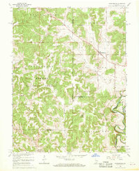
1966 Map of Hardinsburg
USGS Topo · Published 1968About this map
The Indian Treaty Boundary cuts a historical diagonal across this Southern Indiana landscape, marking a former frontier line between Orange and Washington counties. This 1966 revision shows a region defined by its karst topography and wooded uplands, much of which is protected within the Hoosier National Forest. The settlement of Hardinsburg sits at the intersection of local routes, while the town of Marengo anchors the southwest corner near the Whiskey Run drainage. Rural life is anchored by numerous small congregations and burying grounds, such as Baptist Hill Ch and Providence Cem. Significant water features like the Blue River and the meandering Patoka River indicate the complex drainage of the area, including the subterranean character suggested by Sinking Creek. The presence of a Quarry and a Radio Tower point to mid-century industrial and communications infrastructure amid the predominantly agricultural and forested terrain.
Find a feature on this map
49 named features on this map. Tap any name to fly to it.
Don’t see what you’re looking for? This feature index may not catch every label — zoom into the map to look around manually.
Map Details
Editions of this 1966 Hardinsburg Map
2 editions found
Other maps of this area

1946 · Depauw
USGS Topo · 1:24,000

1947 · Hardinsburg
USGS Topo · 1:24,000

1948 · Milltown
USGS Topo · 1:24,000

1949 · Hardinsburg
USGS Topo · 1:24,000

1950 · Becks Mill
USGS Topo · 1:24,000

1950 · Valeene
USGS Topo · 1:24,000

1950 · English
USGS Topo · 1:24,000

1953 · Fredericksburg
USGS Topo · 1:24,000

1956 · Vincennes
USGS Topo · 1:250,000

1957 · Vincennes
USGS Topo · 1:250,000