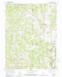
1966 Map of Hardinsburg
USGS Topo · Published 1990About this map
Hardinsburg sits at the intersection of several early transport routes, including the Old Pike and Hardinsburg Road, serving as a central hub in this Southern Indiana landscape. The terrain is defined by complex water systems, notably the Blue River at Horseshoe Bend and the subterranean-leaning hydrology of Sinking Creek and Whiskey Run. Large portions of the western half are managed as part of the Hoosier National Forest, showing a transition from agricultural use to protected woodland. Genealogists will find a wealth of local history in the distribution of family-named sites and rural institutions, such as Providence Cem, Totten Cem, and Baptist Hill Ch. Significant boundary lines, including the historic Treaty Boundary and multiple county borders, crisscross the townships of Stampers Creek, Madison, and Posey.
Find a feature on this map
43 named features on this map. Tap any name to fly to it.
Don’t see what you’re looking for? This feature index may not catch every label — zoom into the map to look around manually.
Map Details
Editions of this 1966 Hardinsburg Map
2 editions found
Other maps of this area

1946 · Depauw
USGS Topo · 1:24,000

1947 · Hardinsburg
USGS Topo · 1:24,000

1948 · Milltown
USGS Topo · 1:24,000

1949 · Hardinsburg
USGS Topo · 1:24,000

1950 · Becks Mill
USGS Topo · 1:24,000

1950 · Valeene
USGS Topo · 1:24,000

1950 · English
USGS Topo · 1:24,000

1953 · Fredericksburg
USGS Topo · 1:24,000

1956 · Vincennes
USGS Topo · 1:250,000

1957 · Vincennes
USGS Topo · 1:250,000