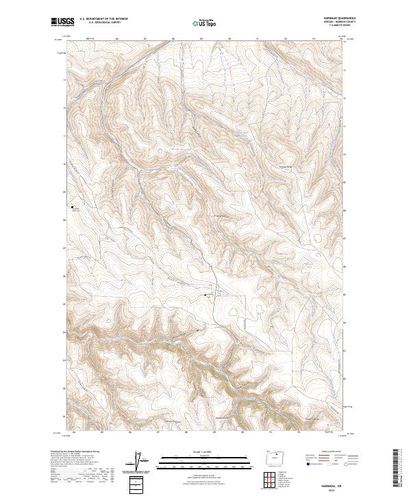
2024 Map of Hardman
USGS Topo · Published 2024About this map
Hardman Cem and the Hardman IOOF Cem serve as central points of historical interest in this portion of Morrow County, where the high-altitude terrain is defined by complex drainage systems and steep descents. The landscape is marked by the convergence of several major canyons, including Merrill Canyon, Rood Canyon, and Miller Canyon, which channel seasonal water toward Rock Creek. These geographic features dictate the winding paths of local thoroughfares like Wyland Grade Rd and Hardman Ridge Rd, reflecting the challenges of traversing this dissected plateau.
Find a feature on this map
39 named features on this map. Tap any name to fly to it.
Don’t see what you’re looking for? This feature index may not catch every label — zoom into the map to look around manually.
Map Details
Editions of this 2024 Hardman Map
This is the sole edition of this map. No revisions or reprints were ever made.
Other maps of this area

1953 · Pendleton
USGS Topo · 1:250,000

1956 · Pendleton
USGS Topo · 1:250,000

1968 · Eightmile
USGS Topo · 1:24,000

1968 · Ruggs
USGS Topo · 1:24,000

1968 · Heppner
USGS Topo · 1:24,000

1969 · Lefevre Prairie
USGS Topo · 1:24,000

1969 · Buttermilk Canyon
USGS Topo · 1:24,000

1969 · Chapin Creek
USGS Topo · 1:24,000

1969 · Hardman
USGS Topo · 1:24,000

1969 · Big Rock Flat
USGS Topo · 1:24,000