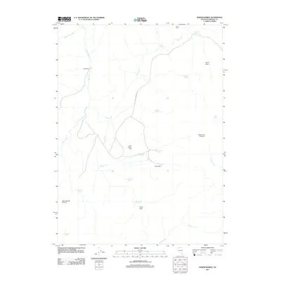
2011 Map of Hardscrabble
USGS Topo · Published 2011About this map
Hardscrabble centers this high-desert landscape in Humboldt County, where ranching history and rugged topography converge. The terrain is marked by essential water management features like Goat Corral Flat Reservoir, Buckhorn Reservoir, and Horse Basin Reservoir, which support livestock in an arid environment defined by the Ararat Hills and Goat Corral Mountain. Transport through this portion of Nevada relies on the prominent Greely Crossing Rd, which navigates the drainage basins of Martin Creek and Rock Creek. These waterways, along with numerous named springs such as Reinhart Spring and Rattlesnake Spring, illustrate the critical importance of water sources to the remote outposts and geographic identity of the region.
Find a feature on this map
26 named features on this map. Tap any name to fly to it.
Don’t see what you’re looking for? This feature index may not catch every label — zoom into the map to look around manually.
Map Details
Editions of this 2011 Hardscrabble Map
This is the sole edition of this map. No revisions or reprints were ever made.
Other maps of this area

1882 · Paradise
USGS Topo · 1:250,000

1893 · Paradise
USGS Topo · 1:250,000

1945 · Hot Springs
USGS Topo · 1:62,500

1947 · Hot Springs Peak
USGS Topo · 1:62,500

1955 · McDermitt
USGS Topo · 1:250,000

1959 · McDermitt
USGS Topo · 1:250,000

1980 · Black Ridge
USGS Topo · 1:24,000

1980 · Greeley Flat
USGS Topo · 1:24,000

1980 · Hardscrabble
USGS Topo · 1:24,000

1980 · Spring City
USGS Topo · 1:24,000