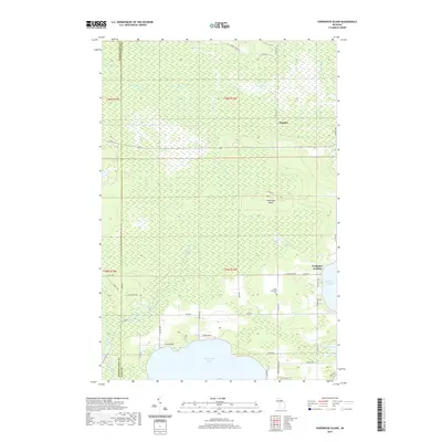
2019 Map of Hardwood Island
USGS Topo · Published 2019About this map
Manistique Lake and North Manistique Lake dominate the southern landscape of this Upper Peninsula survey, where the low-lying terrain is defined by a complex network of wetlands and seasonal waterways. The boundary between Schoolcraft and Luce counties cuts through the western edge of the area, a region where the E Br Fox River meanders through expansive marshes known locally as The Spreads. Small settlements and landing points like Danaher and Carpenter Landing provide a glimpse into the local accessibility of these northern waters.
Find a feature on this map
85 named features on this map. Tap any name to fly to it.
Don’t see what you’re looking for? This feature index may not catch every label — zoom into the map to look around manually.
Map Details
Editions of this 2019 Hardwood Island Map
This is the sole edition of this map. No revisions or reprints were ever made.
Other maps of this area

1931 · Seney SW
USGS Topo · 1:31,680

1931 · Seney NW
USGS Topo · 1:31,680

1931 · Gould City NW
USGS Topo · 1:31,680

1931 · Seney SE
USGS Topo · 1:31,680

1931 · Blaney NE
USGS Topo · 1:31,680

1931 · Blaney NW
USGS Topo · 1:31,680

1954 · Sault Sainte Marie
USGS Topo · 1:250,000

1956 · Sault Sainte Marie
USGS Topo · 1:250,000

1957 · Sault Sainte Marie
USGS Topo · 1:250,000

1958 · Sault Sainte Marie
USGS Topo · 1:250,000