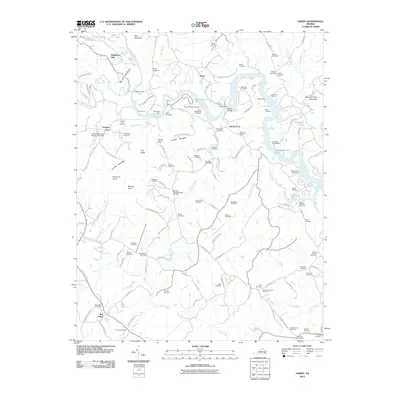
2011 Map of Hardy
USGS Topo · Published 2011About this map
Lynville Mountain and the Blue Ridge rise above a landscape defined by the winding course of the Roanoke River and the expanding waters of Smith Mountain Lake. This geography is dense with genealogical detail, featuring dozens of family-named burial sites such as the Amos-Richardson Cemetery, McVeighs Cemetery, and Swain-Basham Cemetery. Historically significant river crossings are well-preserved in the record, including Blackwater Ford, Horns Ford, and Webbs Ford, marking where early travelers once navigated these waters before modern infrastructure like the Hardy Bridge.
Find a feature on this map
138 named features on this map. Tap any name to fly to it.
Don’t see what you’re looking for? This feature index may not catch every label — zoom into the map to look around manually.
Map Details
Editions of this 2011 Hardy Map
This is the sole edition of this map. No revisions or reprints were ever made.
Other maps of this area

1890 · Roanoke
USGS Topo · 1:125,000

1891 · Roanoke
USGS Topo · 1:125,000

1929 · Roanoke
USGS Topo · 1:48,000

1933 · Roanoke
USGS Topo · 1:62,500

1947 · Roanoke
USGS Topo · 1:250,000

1950 · Peaks of Otter
USGS Topo · 1:62,500

1951 · Boones Mill
USGS Topo · 1:62,500

1951 · Moneta
USGS Topo · 1:62,500

1959 · Roanoke
USGS Topo · 1:250,000
1962 · Roanoke
USGS Topo · 1:24,000