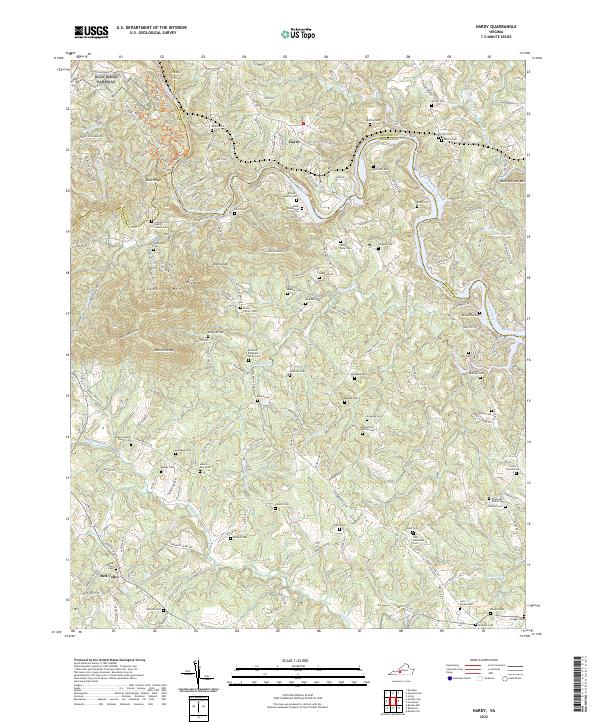
2022 Map of Hardy
USGS Topo · Published 2022About this map
Hardy and its surrounding countryside in Bedford and Franklin counties are defined by a complex network of creeks and numerous family cemeteries that dot the foothills of the Blue Ridge Mountains. The Roanoke River cuts through the northern section of the landscape, joined by tributaries such as Lynville Cr and Gills Cr. This area is particularly notable for its dense concentration of historical burial grounds, including the Amos-Richardson Cem, Garland-Ridgeway-Smith Cem, and Robertson Plybon Cem, which suggest a long-standing pattern of family-centered land ownership. The northern edge of the terrain is traced by the Blue Ridge Parkway, while the interior is accessible via State Rte 618 and State Rte 679, connecting smaller settlements like Red Valley and Blue Ridge. Local spiritual centers such as the Mount Lebanon Church Cem and Coopers Cove Baptist Church Cem serve as landmarks for the community.
Find a feature on this map
70 named features on this map. Tap any name to fly to it.
Don’t see what you’re looking for? This feature index may not catch every label — zoom into the map to look around manually.
Map Details
Editions of this 2022 Hardy Map
This is the sole edition of this map. No revisions or reprints were ever made.
Other maps of this area

1890 · Roanoke
USGS Topo · 1:125,000

1891 · Roanoke
USGS Topo · 1:125,000

1929 · Roanoke
USGS Topo · 1:48,000

1933 · Roanoke
USGS Topo · 1:62,500

1947 · Roanoke
USGS Topo · 1:250,000

1950 · Peaks of Otter
USGS Topo · 1:62,500

1951 · Boones Mill
USGS Topo · 1:62,500

1951 · Moneta
USGS Topo · 1:62,500

1959 · Roanoke
USGS Topo · 1:250,000
1962 · Roanoke
USGS Topo · 1:24,000