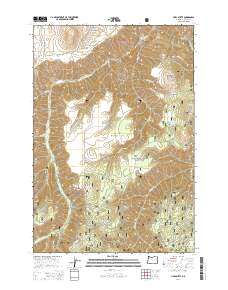
2014 Map of Harl Butte
USGS Topo · Published 2014About this map
Wallowa National Forest land defines this portion of the high country, where the landscape is marked by prominent rises like Harl Butte and Needham Butte. The map provides a detailed view of the drainage patterns feeding into Big Sheep Creek and its many tributaries, including Needham Creek and Coyote Creek. Named fords and crossings are absent, but the network of forest roads and trails, such as Deadhorse Ridge Road and the NFD 3540 Trail, indicates the accessibility of these high ridges and canyons for timber and range management.
Find a feature on this map
39 named features on this map. Tap any name to fly to it.
Don’t see what you’re looking for? This feature index may not catch every label — zoom into the map to look around manually.
Map Details
Editions of this 2014 Harl Butte Map
This is the sole edition of this map. No revisions or reprints were ever made.
Other maps of this area

1954 · Cornucopia
USGS Topo · 1:62,500

1954 · Harl Butte
USGS Topo · 1:62,500

1955 · Grangeville
USGS Topo · 1:250,000

1957 · Joseph
USGS Topo · 1:62,500

1957 · Homestead
USGS Topo · 1:62,500

1959 · Grangeville
USGS Topo · 1:250,000

1986 · Enterprise
USGS Topo · 1:100,000

1987 · Riggins
USGS Topo · 1:100,000
1990 · Puderbaugh Ridge
USGS Topo · 1:24,000
1990 · Gumboot Butte
USGS Topo · 1:24,000