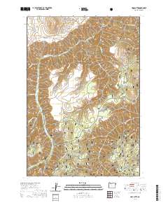
2020 Map of Harl Butte
USGS Topo · Published 2020About this map
Wallowa National Forest defines the high-elevation landscape of this 2020 topographic survey, where steep ridges and deep gulches create a complex drainage network. The terrain is anchored by prominent summits like Needham Butte and Harl Butte, while lower-lying areas such as Marr Flat provide occasional breaks in the verticality. Water sources are critical in this environment, marked by sites like Spoon Spring and Double Hitch Spring, alongside numerous seasonal drainages including Big Sheep Creek and Waqimatau Creek.
Find a feature on this map
38 named features on this map. Tap any name to fly to it.
Don’t see what you’re looking for? This feature index may not catch every label — zoom into the map to look around manually.
Map Details
Editions of this 2020 Harl Butte Map
This is the sole edition of this map. No revisions or reprints were ever made.
Other maps of this area

1954 · Cornucopia
USGS Topo · 1:62,500

1954 · Harl Butte
USGS Topo · 1:62,500

1955 · Grangeville
USGS Topo · 1:250,000

1957 · Joseph
USGS Topo · 1:62,500

1957 · Homestead
USGS Topo · 1:62,500

1959 · Grangeville
USGS Topo · 1:250,000

1986 · Enterprise
USGS Topo · 1:100,000

1987 · Riggins
USGS Topo · 1:100,000
1990 · Puderbaugh Ridge
USGS Topo · 1:24,000
1990 · Gumboot Butte
USGS Topo · 1:24,000