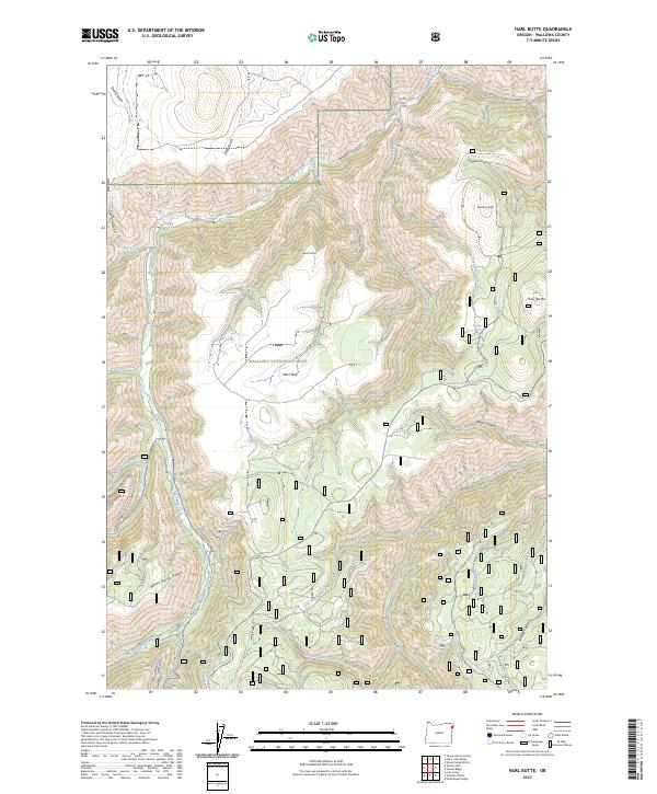
2023 Map of Harl Butte
USGS Topo · Published 2023About this map
Wallowa National Forest land defines the high-altitude topography of this quadrant, where prominent elevations like Harl Butte and Needham Butte overlook a complex network of canyons and gulches. The drainage pattern is led by the south-flowing Big Sheep Creek, which is fed by numerous tributaries including Timber Creek, Griffith Creek, and Road Creek. This area is characterized by steep elevation changes, moving from the open expanse of Marr Flat to the deep incisions of Devils Gulch and Shadow Canyon.
Find a feature on this map
37 named features on this map. Tap any name to fly to it.
Don’t see what you’re looking for? This feature index may not catch every label — zoom into the map to look around manually.
Map Details
Editions of this 2023 Harl Butte Map
This is the sole edition of this map. No revisions or reprints were ever made.
Other maps of this area

1954 · Cornucopia
USGS Topo · 1:62,500

1954 · Harl Butte
USGS Topo · 1:62,500

1955 · Grangeville
USGS Topo · 1:250,000

1957 · Joseph
USGS Topo · 1:62,500

1957 · Homestead
USGS Topo · 1:62,500

1959 · Grangeville
USGS Topo · 1:250,000

1986 · Enterprise
USGS Topo · 1:100,000

1987 · Riggins
USGS Topo · 1:100,000
1990 · Puderbaugh Ridge
USGS Topo · 1:24,000
1990 · Gumboot Butte
USGS Topo · 1:24,000