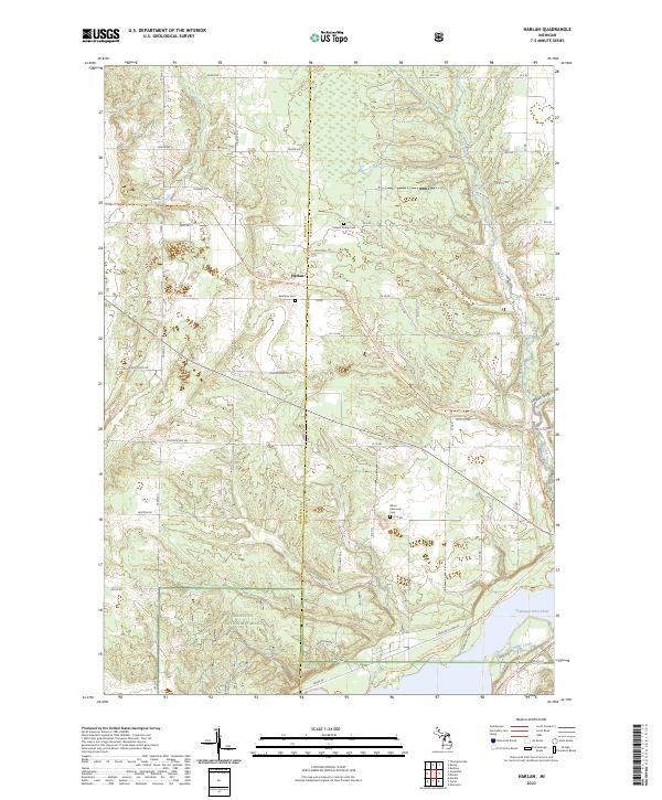
2023 Map of Harlan
USGS Topo · Published 2023About this map
Harlan serves as a central point in this part of Wexford County, where the settlement is surrounded by a network of rural section roads and forestry tracks. The landscape is defined by the edge of the Manistee National Forest, featuring a mix of woodland and open spaces cut through by the Betsie Valley State Trl. This area shows a distinct pattern of local history through its small burial grounds, including the Crowell Family Cem and Brethren Cem. To the southeast, the terrain descends toward the water, marked by the presence of Hodenpyl Dam Pond and various tributaries such as First Creek and Cripple Creek. The map provides a clear look at the township grid, illustrating the transition from the concentrated lots in town to the larger timberlands and valleys like Snooky Valley.
Find a feature on this map
90 named features on this map. Tap any name to fly to it.
Don’t see what you’re looking for? This feature index may not catch every label — zoom into the map to look around manually.
Map Details
Editions of this 2023 Harlan Map
This is the sole edition of this map. No revisions or reprints were ever made.
Other maps of this area

1954 · Traverse City
USGS Topo · 1:250,000

1956 · Kingsley
USGS Topo · 1:62,500

1956 · Mesick
USGS Topo · 1:62,500

1956 · Thompsonville
USGS Topo · 1:62,500

1957 · Copemish
USGS Topo · 1:62,500

1958 · Traverse City
USGS Topo · 1:250,000
1976 · Thompsonville SW
USGS Topo · 1:24,000

1976 · Thompsonville SE
USGS Topo · 1:24,000

1983 · Cadillac
USGS Topo · 1:100,000
1983 · Thompsonville
USGS Topo · 1:25,000