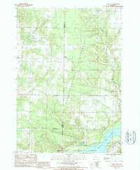
1987 Map of Harlan
USGS Topo · Published 1988About this map
Harlan and Bagnall serve as the primary focal points in this survey of the corner of Manistee and Wexford counties during the late 1980s. The landscape is defined by the expansive Pere Marquette State Forest and Manistee National Forest, where the terrain is carved by First Creek, Fletcher Creek, and the distinctive Sneaky Val. The southern portion of the map is dominated by the waters of the Hodenpyl Dam Pond, a significant reservoir that supports a Boat Launch, Campgrounds, and a dedicated Picnic Area.
Find a feature on this map
25 named features on this map. Tap any name to fly to it.
Don’t see what you’re looking for? This feature index may not catch every label — zoom into the map to look around manually.
Map Details
Editions of this 1987 Harlan Map
This is the sole edition of this map. No revisions or reprints were ever made.
Other maps of this area

1954 · Traverse City
USGS Topo · 1:250,000

1956 · Kingsley
USGS Topo · 1:62,500

1956 · Mesick
USGS Topo · 1:62,500

1956 · Thompsonville
USGS Topo · 1:62,500

1957 · Copemish
USGS Topo · 1:62,500

1958 · Traverse City
USGS Topo · 1:250,000
1976 · Thompsonville SW
USGS Topo · 1:24,000

1976 · Thompsonville SE
USGS Topo · 1:24,000

1983 · Cadillac
USGS Topo · 1:100,000
1983 · Thompsonville
USGS Topo · 1:25,000