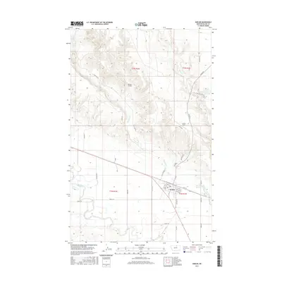
2017 Map of Harlem
USGS Topo · Published 2017About this map
Harlem serves as a concentrated hub of commerce and transit along the northern banks of the Milk River in this part of Montana. The town's grid is well-defined by local landmarks such as the Harlem Cem and the Harlem Airport, while a network of named roads like Thirty-Mile Rd and Madras Rd extend into the surrounding plains. The landscape is heavily influenced by water management, evidenced by the Harlem Canal and the Thirtymile Reservoir, which support the agricultural lifeblood of the region. Natural drainage patterns are marked by several seasonal and permanent waterways, including Thirtymile Creek, Forgey Cr, and the distinct terrain of Borders Coulee. This survey captures the town just as its grid and irrigation infrastructure matured to serve the vast Blaine County landscape.
Find a feature on this map
42 named features on this map. Tap any name to fly to it.
Don’t see what you’re looking for? This feature index may not catch every label — zoom into the map to look around manually.
Map Details
Editions of this 2017 Harlem Map
This is the sole edition of this map. No revisions or reprints were ever made.
Other maps of this area

1903 · Wayne Creek
USGS Topo · 1:62,500

1905 · Wayne Creek
USGS Topo · 1:62,500

1905 · Harlem
USGS Topo · 1:62,500

1913 · Cherry Ridge
USGS Topo · 1:125,000

1953 · Havre
USGS Topo · 1:250,000

1957 · Havre
USGS Topo · 1:250,000

1958 · Havre
USGS Topo · 1:250,000

1964 · Threemile Reservoir
USGS Topo · 1:24,000
1964 · Fort Belknap Agency
USGS Topo · 1:24,000
1964 · Big Coulee
USGS Topo · 1:24,000