
1905 Map of Harlem
USGS Topo · Published 1905About this map
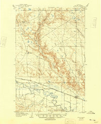
The Milk River valley serves as the central artery for this 1903 survey, revealing an early 20th-century landscape of agricultural expansion and infrastructure. The southern portion of the map is dominated by the northern reaches of the Fort Belknap Indian Reservation, while the town of Harlem sits as a vital rail point along the Great Northern R R. This era saw significant investment in water management to support homesteading, evidenced by the presence of a Dam and several irrigation channels including the Harlem Canal and the Paradise Canal.
Find a feature on this map
18 named features on this map. Tap any name to fly to it.
Don’t see what you’re looking for? This feature index may not catch every label — zoom into the map to look around manually.
Map Details
Editions of this 1905 Harlem Map
2 editions found
Other maps of this area

1903 · Wayne Creek
USGS Topo · 1:62,500

1904 · Chinook
USGS Topo · 1:62,500

1905 · Wayne Creek
USGS Topo · 1:62,500

1912 · Zurich
USGS Topo · 1:125,000

1913 · Cherry Ridge
USGS Topo · 1:125,000

1953 · Havre
USGS Topo · 1:250,000

1956 · Cleveland
USGS Topo · 1:62,500

1957 · Havre
USGS Topo · 1:250,000

1958 · Havre
USGS Topo · 1:250,000

1964 · Threemile Reservoir
USGS Topo · 1:24,000