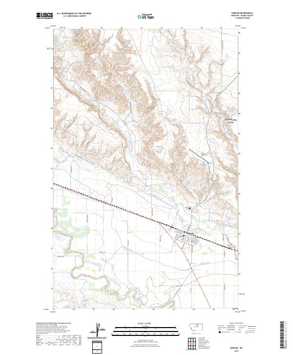
2024 Map of Harlem
USGS Topo · Published 2024About this map
The Milk River valley near Harlem is defined by a complex irrigation network essential to this northern Montana agricultural landscape. The presence of the Harlem Canal and the Fort Belknap Canal illustrates the historical and ongoing management of water resources in Blaine County. To the north, the North Harlem Colony represents the region's communal agricultural settlements, situated among the draws of Borders Coulee and Thirtymile Creek. The town of Harlem itself serves as a local hub, featuring a grid of residential streets like 1st Ave SW and Central Ave W, along with the Harlem Airport and Harlem Cem. This recent survey details the enduring connection between the river's flow and the local economy, from the valley floor to the high ground near Forgey Creek.
Find a feature on this map
37 named features on this map. Tap any name to fly to it.
Don’t see what you’re looking for? This feature index may not catch every label — zoom into the map to look around manually.
Map Details
Editions of this 2024 Harlem Map
This is the sole edition of this map. No revisions or reprints were ever made.
Other maps of this area

1903 · Wayne Creek
USGS Topo · 1:62,500

1905 · Wayne Creek
USGS Topo · 1:62,500

1905 · Harlem
USGS Topo · 1:62,500

1913 · Cherry Ridge
USGS Topo · 1:125,000

1953 · Havre
USGS Topo · 1:250,000

1957 · Havre
USGS Topo · 1:250,000

1958 · Havre
USGS Topo · 1:250,000

1964 · Threemile Reservoir
USGS Topo · 1:24,000
1964 · Fort Belknap Agency
USGS Topo · 1:24,000
1964 · Big Coulee
USGS Topo · 1:24,000