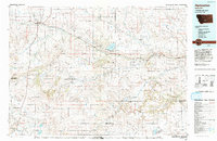
1993 Map of Harlowton
USGS Topo · Published 1993About this map
The Musselshell River winds through this central Montana landscape, defining a corridor of settlement and transport that connects Harlowton to Ryegate. In the early 1990s, the region's agricultural character is evident in the presence of the Springwater Colony and Golden Valley Colony, alongside the extensive irrigation and water management infrastructure at Deadmans Basin Reservoir. The map captures the lingering imprint of the railroad era, tracing the Old Railroad Grade as it parallels Highway 12 through small sidings and communities like Shawmut and Barber.
Find a feature on this map
55 named features on this map. Tap any name to fly to it.
Don’t see what you’re looking for? This feature index may not catch every label — zoom into the map to look around manually.
Map Details
Editions of this 1993 Harlowton Map
This is the sole edition of this map. No revisions or reprints were ever made.
Other maps of this area

1886 · Little Belt Mts.
USGS Topo · 1:250,000

1889 · Big Snowy Mountain
USGS Topo · 1:250,000

1891 · Livingston
USGS Topo · 1:250,000

1891 · Big Timber
USGS Topo · 1:125,000

1892 · Stillwater
USGS Topo · 1:125,000

1893 · Livingston
USGS Topo · 1:250,000

1893 · Big Snowy Mountain
USGS Topo · 1:250,000

1893 · Big Timber
USGS Topo · 1:125,000

1894 · Little Belt Mts.
USGS Topo · 1:250,000

1897 · Little Belt Mts.
USGS Topo · 1:250,000