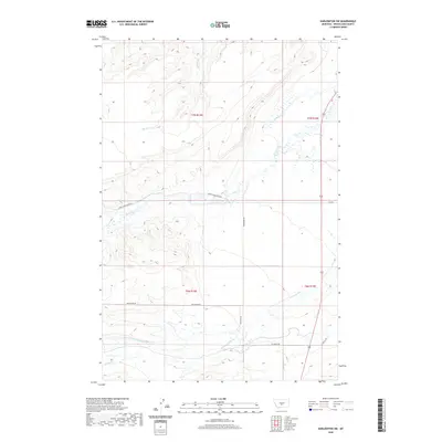
2020 Map of Harlowton SW
USGS Topo · Published 2020About this map
American Fork and its tributaries define this section of Wheatland County, showing a landscape shaped by drainage and ranching access. The hydrology of the region is well-documented, with Lebo Cr, Milton Cr, and Labrie Cr carving distinct paths through the terrain. These watercourses are vital landmarks in an area dominated by large-scale land divisions and ranching operations, such as those accessed by Lower Lebo Ranch Rd. The road network, including the curiously named Moonshine Rd and the connector Langston Rd, provides a clear view of the rural infrastructure supporting the local economy. Genealogists and historians can trace the intersection of historical survey lines like T7N R14E and T6N R15E with physical features like Mud Cr and Spring Cr to locate specific family land holdings or early twentieth-century homesteads.
Find a feature on this map
15 named features on this map. Tap any name to fly to it.
Don’t see what you’re looking for? This feature index may not catch every label — zoom into the map to look around manually.
Map Details
Editions of this 2020 Harlowton SW Map
This is the sole edition of this map. No revisions or reprints were ever made.
Other maps of this area

1886 · Little Belt Mts.
USGS Topo · 1:250,000

1889 · Big Snowy Mountain
USGS Topo · 1:250,000

1893 · Big Snowy Mountain
USGS Topo · 1:250,000

1894 · Little Belt Mts.
USGS Topo · 1:250,000

1897 · Little Belt Mts.
USGS Topo · 1:250,000

1898 · Little Belt Mts.
USGS Topo · 1:250,000

1902 · Little Belt Mts.
USGS Topo · 1:250,000

1948 · White Sulphur Springs
USGS Topo · 1:250,000

1954 · Roundup
USGS Topo · 1:250,000

1958 · Roundup
USGS Topo · 1:250,000