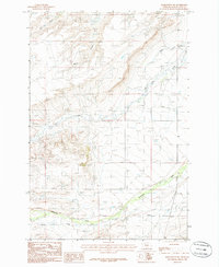
1986 Map of Harlowton SW
USGS Topo · Published 1986About this map
American Fork Creek flows across the southern plains of this Wheatland County landscape, where the high-altitude terrain of central Montana is marked by a complex network of seasonal drainages and cattle country infrastructure. The small settlement of Milton serves as a primary geographic marker in a region defined more by its water sources than its population centers. Water management is central to the area's utility, evidenced by the numerous wells and high-country springs that dot the map, supporting the ranching economy between the basins of Mud Creek and Lebo Creek. A solitary Cem stands as a quiet record of early settlers in this portion of the Musselshell River watershed, while the transition between T 7 N and T 6 N townships organizes the surveyed grid of the open range.
Find a feature on this map
11 named features on this map. Tap any name to fly to it.
Don’t see what you’re looking for? This feature index may not catch every label — zoom into the map to look around manually.
Map Details
Editions of this 1986 Harlowton SW Map
This is the sole edition of this map. No revisions or reprints were ever made.
Other maps of this area

1886 · Little Belt Mts.
USGS Topo · 1:250,000

1889 · Big Snowy Mountain
USGS Topo · 1:250,000

1893 · Big Snowy Mountain
USGS Topo · 1:250,000

1894 · Little Belt Mts.
USGS Topo · 1:250,000

1897 · Little Belt Mts.
USGS Topo · 1:250,000

1898 · Little Belt Mts.
USGS Topo · 1:250,000

1902 · Little Belt Mts.
USGS Topo · 1:250,000

1948 · White Sulphur Springs
USGS Topo · 1:250,000

1954 · Roundup
USGS Topo · 1:250,000

1958 · Roundup
USGS Topo · 1:250,000