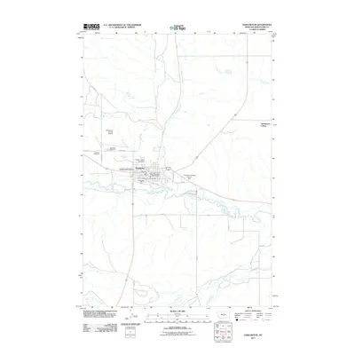
2011 Map of Harlowton
USGS Topo · Published 2011About this map
The Musselshell River winds through the heart of Wheatland County, anchoring the town of Harlowton as it sits at the intersection of several regional routes. This landscape is defined by the convergence of several waterways including Antelope Creek, Jawbone Creek, and Alkali Creek, which have historically shaped the drainage and irrigation patterns of this central Montana region. The presence of Jawbone Dam Number 1 and Jawbone Dam Number 2 highlights the critical role of water management for the surrounding agricultural community and the Springwater Colony situated to the northeast.
Find a feature on this map
29 named features on this map. Tap any name to fly to it.
Don’t see what you’re looking for? This feature index may not catch every label — zoom into the map to look around manually.
Map Details
Editions of this 2011 Harlowton Map
This is the sole edition of this map. No revisions or reprints were ever made.
Other maps of this area

1889 · Big Snowy Mountain
USGS Topo · 1:250,000

1893 · Big Snowy Mountain
USGS Topo · 1:250,000

1954 · Roundup
USGS Topo · 1:250,000

1958 · Roundup
USGS Topo · 1:250,000
1986 · Oka
USGS Topo · 1:24,000
1986 · Ten O'Clock Gate
USGS Topo · 1:24,000
1986 · Hopley Creek North
USGS Topo · 1:24,000
1986 · Devils Pocket
USGS Topo · 1:24,000
1986 · Oxford
USGS Topo · 1:24,000
1986 · Harlowton SW
USGS Topo · 1:24,000