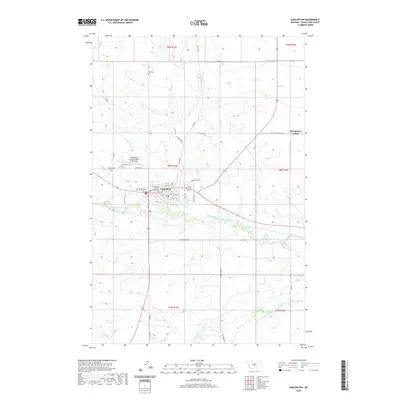
2020 Map of Harlowton
USGS Topo · Published 2020About this map
Harlowton serves as the focal point of this central Montana landscape, situated along the banks of the Musselshell River. The town's grid is clearly defined, featuring civic landmarks such as the Wheatland County Courthouse and its residential streets like NW Pritchard St and A Ave SE. To the northwest, the Wheatland County Airport at Harlowton marks the transition from the town center to the vast agricultural and grazing lands that characterize the county.
Find a feature on this map
46 named features on this map. Tap any name to fly to it.
Don’t see what you’re looking for? This feature index may not catch every label — zoom into the map to look around manually.
Map Details
Editions of this 2020 Harlowton Map
This is the sole edition of this map. No revisions or reprints were ever made.
Other maps of this area

1889 · Big Snowy Mountain
USGS Topo · 1:250,000

1893 · Big Snowy Mountain
USGS Topo · 1:250,000

1954 · Roundup
USGS Topo · 1:250,000

1958 · Roundup
USGS Topo · 1:250,000
1986 · Oka
USGS Topo · 1:24,000
1986 · Ten O'Clock Gate
USGS Topo · 1:24,000
1986 · Hopley Creek North
USGS Topo · 1:24,000
1986 · Devils Pocket
USGS Topo · 1:24,000
1986 · Oxford
USGS Topo · 1:24,000
1986 · Harlowton SW
USGS Topo · 1:24,000