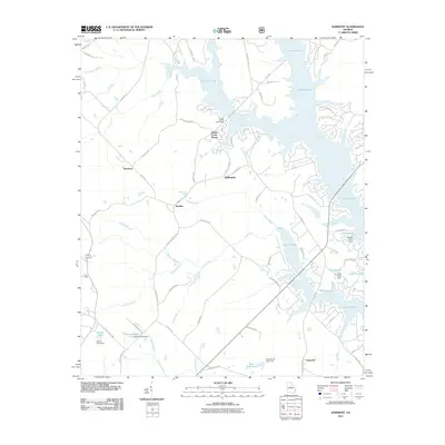
2011 Map of Harmony
USGS Topo · Published 2011About this map
Lake Oconee dominates the eastern and northern portions of this landscape, its sprawling shoreline punctuated by numerous recreational and residential developments like Sugar Creek Boat Ramp. The reservoir, formed by the impoundment of the Oconee River, creates a complex network of inlets and coves where smaller tributaries such as Lick Creek, Jacks Fork, and Glade Branch meet the rising waters. Inland from the lake, the rural character of Putnam County is defined by a series of small, established settlements and crossroads including Harmony, Jefferson, and Glades Cross-Roads. The terrain is further characterized by numerous small private impoundments and dams, such as Walker Lake, Kraft Lake, and Dodson Pond, reflecting the localized water management common in Georgia's Piedmont region during the early 21st century.
Find a feature on this map
74 named features on this map. Tap any name to fly to it.
Don’t see what you’re looking for? This feature index may not catch every label — zoom into the map to look around manually.
Map Details
Editions of this 2011 Harmony Map
This is the sole edition of this map. No revisions or reprints were ever made.
Other maps of this area

1953 · Athens
USGS Topo · 1:250,000

1958 · Athens
USGS Topo · 1:250,000

1959 · Athens
USGS Topo · 1:250,000

1963 · Athens
USGS Topo · 1:250,000

1972 · Liberty
USGS Topo · 1:24,000

1972 · Meda
USGS Topo · 1:24,000

1972 · Eatonton
USGS Topo · 1:24,000

1972 · Buckhead
USGS Topo · 1:24,000

1972 · Harmony
USGS Topo · 1:24,000

1972 · Rock Eagle Lake
USGS Topo · 1:24,000