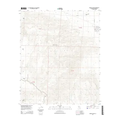
2015 Map of Harper Canyon
USGS Topo · Published 2015About this map
The Vallecito Mountains dominate the central portion of this landscape, creating a complex series of drainage patterns and high-desert flats. In the northeast, the settlement of Little Borrego sits at the edge of the Lower Borrego Valley, where a small grid of streets including Alvarado St and Broadway meet Split Mountain Rd. This area serves as a transition from the structured town layout to the vast alluvial fans of the desert floor.
Find a feature on this map
31 named features on this map. Tap any name to fly to it.
Don’t see what you’re looking for? This feature index may not catch every label — zoom into the map to look around manually.
Map Details
Editions of this 2015 Harper Canyon Map
This is the sole edition of this map. No revisions or reprints were ever made.
Other maps of this area

1931 · Vallecito
USGS Topo · 1:125,000

1931 · Carrizo
USGS Topo · 1:125,000

1939 · Borrego
USGS Topo · 1:62,500

1942 · Barrel Spring
USGS Topo · 1:62,500

1942 · Borego
USGS Topo · 1:62,500

1942 · Carrizo Mtn
USGS Topo · 1:62,500

1942 · Cuyapaipe
USGS Topo · 1:62,500

1943 · Vallecito
USGS Topo · 1:125,000

1947 · Santa Ana
USGS Topo · 1:250,000
1947 · Barrel Spring
USGS Topo · 1:62,500