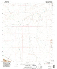
1992 Map of Harpers Well
USGS Topo · Published 1995About this map
Harpers Well stands as a focal point in this arid landscape where the drainage systems of the Lower Borrego Valley and West Mesa converge. The intricate network of desert washes, including San Felipe Creek, Tarantula Wash, and Carrizo Wash, illustrates the hydraulic patterns of the Imperial County desert. Human presence is marked by specialized infrastructure, most notably the Mining Railway and a Dike in the southwest corner, alongside the expansive US Naval Air Facility occupying the eastern portion of the quadrangle. Historical transit is represented by the Old Kane Spring Road, which traverses the northern reaches of the valley, providing a record of desert travel routes before modern development. To the southeast, the rising elevations of the Superstition Hills break the horizontal expanse of the mesa floors.
Find a feature on this map
14 named features on this map. Tap any name to fly to it.
Don’t see what you’re looking for? This feature index may not catch every label — zoom into the map to look around manually.
Map Details
Editions of this 1992 Harpers Well Map
This is the sole edition of this map. No revisions or reprints were ever made.
Other maps of this area

1915 · El Centro
USGS Topo · 1:125,000

1931 · Vallecito
USGS Topo · 1:125,000

1931 · Carrizo
USGS Topo · 1:125,000

1940 · Kane Spring
USGS Topo · 1:62,500

1940 · Plaster City
USGS Topo · 1:62,500

1942 · Barrel Spring
USGS Topo · 1:62,500

1942 · El Centro
USGS Topo · 1:250,000

1942 · Carrizo Mtn
USGS Topo · 1:62,500

1943 · Vallecito
USGS Topo · 1:125,000

1944 · Plaster City
USGS Topo · 1:62,500