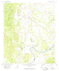
1958 Map of Harpersville
USGS Topo · Published 1969About this map
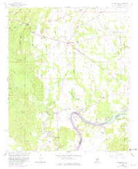
Harpersville and Childersburg anchor this mid-century look at the Coosa River valley, where the landscape is defined by the winding Coosa River and its prominent Cosper Bend. The area reflects a deep-rooted rural infrastructure, with numerous country churches such as Arkwright Ch and Providence Ch, and family-named cemeteries like the Wallace Cems and Kidd Cem. Industrial and transportation activity is evident through the path of the Central of Georgia and Southern railroads, alongside a Strip Mine and various Gravel Pits. Local movement centered around nodes like Gallups Crossroads and Chancellor Crossroads, while the Florida Short Route provided a primary thoroughfare through the rolling terrain of Shelby and Talladega counties.
Find a feature on this map
57 named features on this map. Tap any name to fly to it.
Don’t see what you’re looking for? This feature index may not catch every label — zoom into the map to look around manually.
Map Details
Editions of this 1958 Harpersville Map
5 editions found
Other maps of this area

1890 · Bessemer
USGS Topo · 1:125,000

1890 · Talladega
USGS Topo · 1:125,000

1892 · Talladega
USGS Topo · 1:125,000

1892 · Bessemer
USGS Topo · 1:125,000

1906 · Vandiver
USGS Topo · 1:62,500

1908 · Vandiver
USGS Topo · 1:62,500

1909 · Columbiana
USGS Topo · 1:62,500

1911 · Columbiana
USGS Topo · 1:62,500

1915 · Gantts Quarry
USGS Topo · 1:48,000

1917 · Gantts Quarry
USGS Topo · 1:62,500