1975 Map of Harpersville
USGS Topo · Published 1977About this map
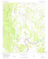
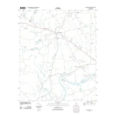
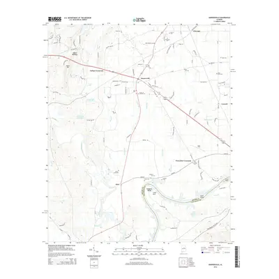
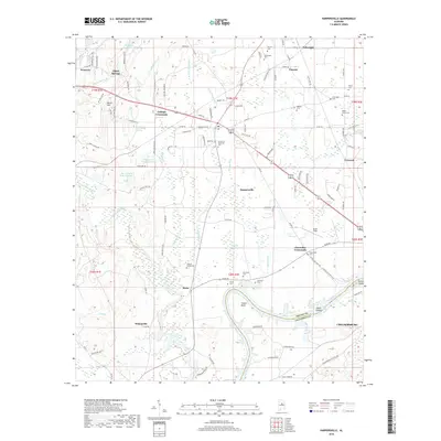
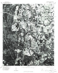
Harpersville and the surrounding Shelby County landscape appear in stark detail through this 1975 orthophotoquad. Unlike traditional topographic maps, this aerial perspective reveals the exact texture of the Alabama countryside, from the concentrated cluster of buildings at the Harpersville crossroads to the dense timberland and agricultural clearings that define the region. To the south, the Coosa River winds through the terrain, broadening into the reservoir of Lay Lake, where the water's edge meets the irregular forest margins and the northern fringes of Childersburg. This imagery, produced in cooperation with the Soil Conservation Service, provides an invaluable record of land use and forest cover during the mid-1970s, showing the specific layout of farmsteads and rural roads before modern suburban expansion altered the local character.
Find a feature on this map
4 named features on this map. Tap any name to fly to it.
Don’t see what you’re looking for? This feature index may not catch every label — zoom into the map to look around manually.
Map Details
Editions of this 1975 Harpersville Map
This is the sole edition of this map. No revisions or reprints were ever made.
Historical Maps of Childersburg Through Time
7 maps found