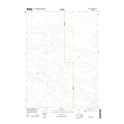
2014 Map of Harr Valley
USGS Topo · Published 2014About this map
Harr Valley and Remalia Valley form the center of this landscape in the Nebraska Sandhills, where the topography is defined by intricate dune formations and isolated depressions. The map documents the high-country drainage and wetland patterns of the region in the early 21st century. The boundary line for Cherry Co Brown Co bisects the terrain, illustrating the political division through this sparse, open rangeland. In the southeastern corner, Moon Lake serves as a primary hydrological landmark, standing out as one of the few named water bodies in a territory otherwise dominated by unnamed ponds and seasonal marshes. The intricate contour lines reveal a complex network of sandy ridges and valleys typical of north-central Nebraska, providing a clear record of the area's physical geography before further environmental or land-use changes.
Find a feature on this map
4 named features on this map. Tap any name to fly to it.
Don’t see what you’re looking for? This feature index may not catch every label — zoom into the map to look around manually.
Map Details
Editions of this 2014 Harr Valley Map
This is the sole edition of this map. No revisions or reprints were ever made.
Other maps of this area

1949 · Long Lake
USGS Topo · 1:62,500

1950 · Wood Lake
USGS Topo · 1:62,500

1950 · Arabia
USGS Topo · 1:62,500

1951 · Long Lake
USGS Topo · 1:62,500

1951 · Moon Lake
USGS Topo · 1:62,500

1957 · Valentine
USGS Topo · 1:250,000

1959 · Valentine
USGS Topo · 1:250,000

1985 · Wilson Valley
USGS Topo · 1:24,000
1985 · Brush Creek
USGS Topo · 1:24,000
1985 · Arabia SE
USGS Topo · 1:24,000