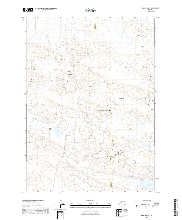
2021 Map of Harr Valley
USGS Topo · Published 2021About this map
Moon Lake anchors the southeastern corner of this map, a prominent water body in a landscape characterized by complex topographic depressions and drainage basins. The area is defined by two major natural features, Harr Valley and Remalia Valley, which structure the terrain across the border of Cherry and Brown Counties. The land use appears largely rural and undeveloped, with very little infrastructure beyond a few isolated corridors like Hill Rd. This high-plains landscape in northern Nebraska shows a pattern of intermittent wetlands and specialized hydrology, typical of the Sandhills region, where the valleys serve as significant geographic markers in a sparsely populated environment.
Find a feature on this map
11 named features on this map. Tap any name to fly to it.
Don’t see what you’re looking for? This feature index may not catch every label — zoom into the map to look around manually.
Map Details
Editions of this 2021 Harr Valley Map
This is the sole edition of this map. No revisions or reprints were ever made.
Other maps of this area

1949 · Long Lake
USGS Topo · 1:62,500

1950 · Wood Lake
USGS Topo · 1:62,500

1950 · Arabia
USGS Topo · 1:62,500

1951 · Long Lake
USGS Topo · 1:62,500

1951 · Moon Lake
USGS Topo · 1:62,500

1957 · Valentine
USGS Topo · 1:250,000

1959 · Valentine
USGS Topo · 1:250,000

1985 · Wilson Valley
USGS Topo · 1:24,000
1985 · Brush Creek
USGS Topo · 1:24,000
1985 · Arabia SE
USGS Topo · 1:24,000