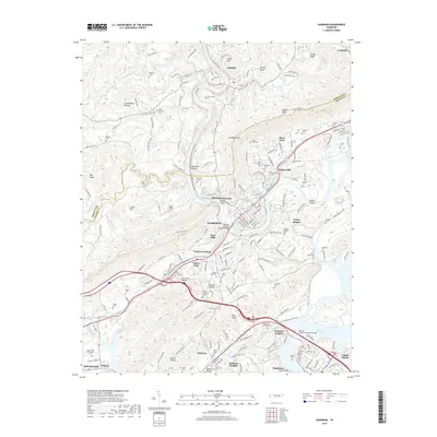
2019 Map of Harriman
USGS Topo · Published 2019About this map
Harriman serves as the central hub of this Roane County study, where the Emory River winds through the gap between the Cumberland Plateau and Walden Ridge. The landscape is defined by the legacy of industrial transit and local memory, evidenced by the concentration of family and community burial grounds like Old Harriman Cem, Bazel Town Cem, and Riggs Chapel Cem. Transportation infrastructure is prominent, including the William Hamilton Browder Bridge spanning the river and the convergence of routes at Harriman Junction. To the south, the expansion of Midtown and Kingston Heights towards Watts Bar Lake shows the modern residential footprint of the region. Educational and recreational landmarks such as Roane State Community Coll and Stowe Bluff anchor the southern reaches of the map near Whiteoak Lake.
Find a feature on this map
205 named features on this map. Tap any name to fly to it.
Don’t see what you’re looking for? This feature index may not catch every label — zoom into the map to look around manually.
Map Details
Editions of this 2019 Harriman Map
This is the sole edition of this map. No revisions or reprints were ever made.
Other maps of this area

1887 · Kingston
USGS Topo · 1:125,000

1891 · Kingston
USGS Topo · 1:125,000

1893 · Briceville
USGS Topo · 1:125,000

1893 · Kingston
USGS Topo · 1:125,000

1895 · Wartburg
USGS Topo · 1:125,000

1895 · Loudon
USGS Topo · 1:125,000

1895 · Briceville
USGS Topo · 1:125,000

1896 · Wartburg
USGS Topo · 1:125,000

1896 · Briceville
USGS Topo · 1:125,000

1935 · Rockwood
USGS Topo · 1:24,000