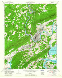
1953 Map of Harriman
USGS Topo · Published 1964About this map
The industrial and river landscape of Roane County comes into sharp focus where the Emory River meets Watts Bar Lake. This mid-century survey documents Harriman at a point of transition, showing the town's dense street grid and its position as a rail hub for the Southern and Tennessee Central railroads. To the south, the massive Kingston Steam Plant appears on a peninsula formed by the confluence of the Clinch River, signaling the era's growing energy infrastructure.
Find a feature on this map
77 named features on this map. Tap any name to fly to it.
Don’t see what you’re looking for? This feature index may not catch every label — zoom into the map to look around manually.
Map Details
Editions of this 1953 Harriman Map
This is the sole edition of this map. No revisions or reprints were ever made.
Other maps of this area

1887 · Kingston
USGS Topo · 1:125,000

1891 · Kingston
USGS Topo · 1:125,000

1893 · Briceville
USGS Topo · 1:125,000

1893 · Kingston
USGS Topo · 1:125,000

1895 · Wartburg
USGS Topo · 1:125,000

1895 · Loudon
USGS Topo · 1:125,000

1895 · Briceville
USGS Topo · 1:125,000

1896 · Wartburg
USGS Topo · 1:125,000

1896 · Briceville
USGS Topo · 1:125,000

1935 · Rockwood
USGS Topo · 1:24,000