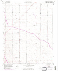
1956 Map of Harris Ranch
USGS Topo · Published 1980About this map
Large-scale agriculture and water management define this landscape in the western San Joaquin Valley. Several prominent holdings, including Harris Ranch and the Benson-Davis Ranch, anchor a region where the grid of named avenues—such as Jeffrey Avenue and Cadillac Avenue—mirrors the industrial precision of the valley's irrigation system. The California Aqueduct cuts diagonally across the terrain, supported by infrastructure like a Pumping Plant and a nearby Levee.
Find a feature on this map
19 named features on this map. Tap any name to fly to it.
Don’t see what you’re looking for? This feature index may not catch every label — zoom into the map to look around manually.
Map Details
Editions of this 1956 Harris Ranch Map
Other maps of this area

1912 · Coalinga
USGS Topo · 1:125,000

1928 · Delta Farms No 3
USGS Topo · 1:31,680

1931 · Wheatville
USGS Topo · 1:31,680

1931 · Towne Oil Station
USGS Topo · 1:31,680

1931 · Mouth of Cantua Creek
USGS Topo · 1:31,680

1932 · Delta Farms
USGS Topo · 1:31,680

1932 · West of Lethent
USGS Topo · 1:31,680

1933 · Huron
USGS Topo · 1:31,680

1933 · Guijarral Hills
USGS Topo · 1:31,680
1936 · Guijarral Hills
USGS Topo · 1:31,680