
1943 Map of Harrisburg
USGS Topo · Published 1943About this map
Harrisburg is the industrial and political anchor of this mid-century landscape, positioned along the east bank of the Susquehanna River. The map captures a complex transport corridor where the Pennsylvania and Reading railroads follow the river's path through gaps in the Blue Mountain and Stony Mountains ridges. Beyond the urban core, the terrain is dotted with small agrarian and industrial settlements like Halifax, Dauphin, and Marysville, each connected by the William Penn Highway.
Find a feature on this map
97 named features on this map. Tap any name to fly to it.
Don’t see what you’re looking for? This feature index may not catch every label — zoom into the map to look around manually.
Map Details
Editions of this 1943 Harrisburg Map
3 editions found
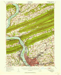
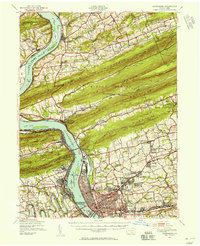
Other maps of this area

1892 · Lykens
USGS Topo · 1:62,500

1892 · Hummelstown
USGS Topo · 1:62,500

1892 · Harrisburg
USGS Topo · 1:62,500

1893 · Lykens
USGS Topo · 1:62,500

1893 · Millersburg
USGS Topo · 1:62,500

1899 · Harrisburg
USGS Topo · 1:62,500

1904 · Carlisle
USGS Topo · 1:62,500

1906 · New Cumberland
USGS Topo · 1:62,500

1907 · New Bloomfield
USGS Topo · 1:62,500

1907 · Millerstown
USGS Topo · 1:62,500
Featured Places
- Harrisburg, PA
- Colonial Park, Lower Paxton Township
- Progress, Susquehanna Township
- Linglestown, Lower Paxton Township
- Enola, East Pennsboro Township