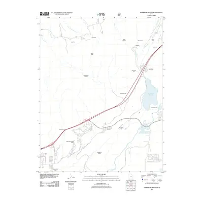
2011 Map of Harrisburg Junction
USGS Topo · Published 2011About this map
Harrisburg and Harrisburg Junction serve as the primary human touchpoints in this 2011 survey of the southern Utah landscape, where modern infrastructure meets geologic complexity. The area is defined by massive sedimentary formations, most notably the prominent Washington Black Ridge, Leeds Reef, and the White Reef situated near the historic Cobb Mine. The Virgin River flows along the southern reach of the quadrangle, while the Quail Creek Reservoir provides a significant water feature amidst the arid terrain of Harrisburg Flat and Purgatory Flat. Local transport is anchored by I-15 and Telegraph Rd, tracing paths through the distinctive gap between Cottonwood Hill and Harrisburg Gap. For those interested in the recreational and working history of the region, the map details the location of the Red Cliffs Campground and several named washes and canyons including Water Canyon and Yankee Doodle Hollow Creek.
Find a feature on this map
44 named features on this map. Tap any name to fly to it.
Don’t see what you’re looking for? This feature index may not catch every label — zoom into the map to look around manually.
Map Details
Editions of this 2011 Harrisburg Junction Map
This is the sole edition of this map. No revisions or reprints were ever made.
Other maps of this area

1885 · St. George
USGS Topo · 1:250,000

1891 · St. George
USGS Topo · 1:250,000

1953 · Cedar City
USGS Topo · 1:250,000

1954 · La Verkin 3 NW
USGS Topo · 1:24,000

1954 · La Verkin 3 NE
USGS Topo · 1:24,000

1954 · La Verkin 3 SE
USGS Topo · 1:24,000

1954 · La Verkin 3 SW
USGS Topo · 1:24,000

1954 · La Verkin 2 SE
USGS Topo · 1:24,000

1954 · St. George
USGS Topo · 1:62,500

1954 · Hurricane
USGS Topo · 1:62,500